
I came across a gorgeous map of France today while doing some research on how long mail would take to go from London to the south of France in the 1830s.
One of the things I do to make money is freelance historical research for period authors who just want to write and don't want to worry about making sure the details are historically accurate. I do the nitty gritty research work for them :) I got into this work kind of randomly, my sister writes romance novels set in the Regency period and I started off doing research for her before she introduced me to more of her author friends. At this point I have more of this freelance historical research available to me than I have time to do it; this could easily be my full time job if I wanted to quit my position as a project manager at a market research company (I actually make more on a per hour basis doing this then I get paid at my "real" job). If I wasn't getting cross-trained at my day job and gaining experience in the analysis side of the research industry I would probably just jump full on into the historical research. It is a lot of fun diving into different time periods and wading through original sources. In this day and age so many universities are digitizing their archives that you can find a surprising amount of books from the 18th and 19th century that are full text searchable.
Map of Communication Times between Paris and the rest of France - 1882
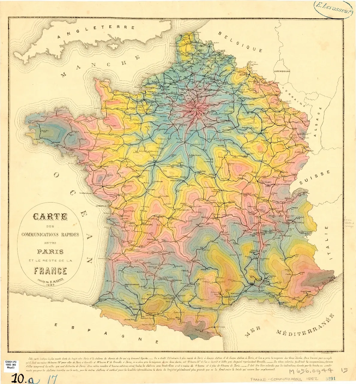
This map shows travel times from Paris as gradient tints. You can see the major transportation arteries and the slower diffusion out into the countryside. I think this is a particularly striking map but many old maps are works of art. This map is part of the collection of the University of Chicago - check out their online collection of maps here:
https://www.lib.uchicago.edu/e/collections/maps/
At the above link you can find maps of:
- Paris in the 19th century
- Late 19th- and early 20th-century Asian cities
- Late 19th- and early 20th-century Latin American cities
- Ethnographic maps of the 19th century
- European transportation maps of the 19th century
- Late 19th- and early 20th-century European city-planning maps
- 18th-century maps of Central Europe
- 19th-Century Maps of the Middle East, North Africa, and Central Asia
Have fun and happy hunting!
Cheers - Carl