Not a whisper of suburbia.
Bird's Nest Ferns. Xanthorrhoeas.
Leeches. Screams that not a soul would hear.
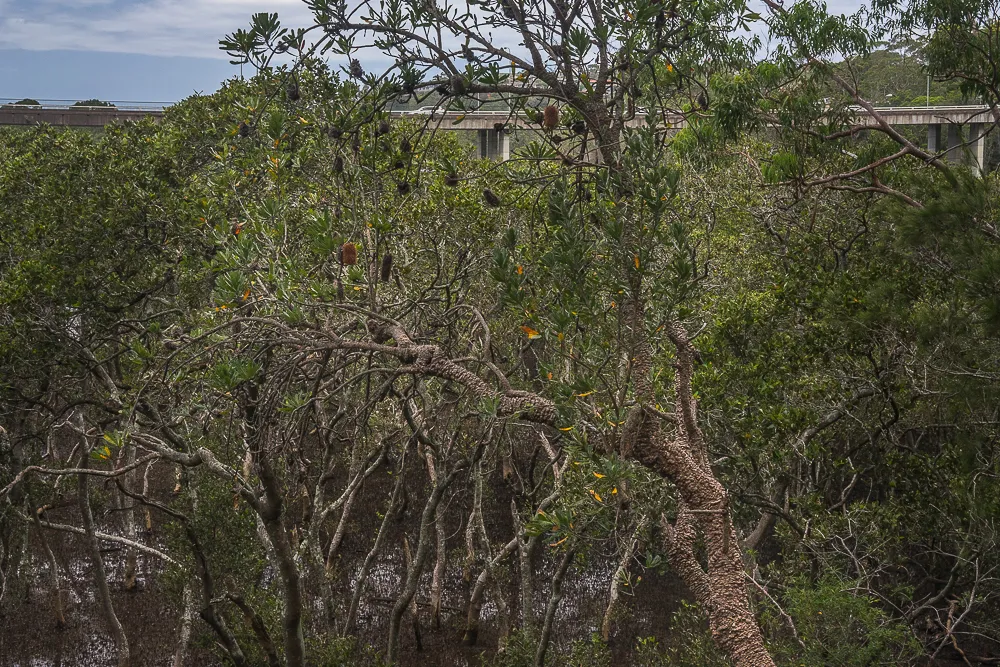
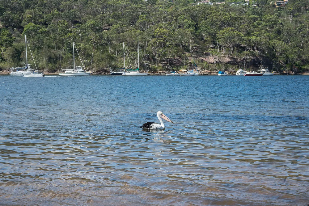
Mangroves. Sand. Water. Lizards. Sea gulls. Pelicans. Boats.
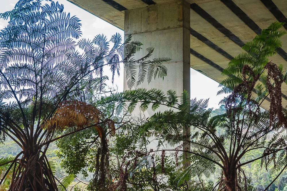
Tingling feet. Blissful shade. Gentle humming of the Roseville Bridge. ~Ally.
In my article The Enchanted Forest I took you on a small journey, in the rain, to Moores Creek.
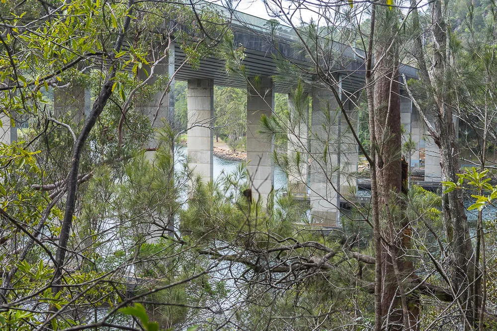
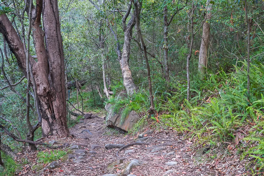
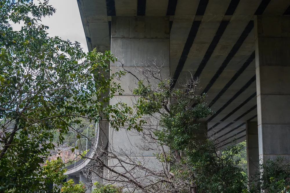
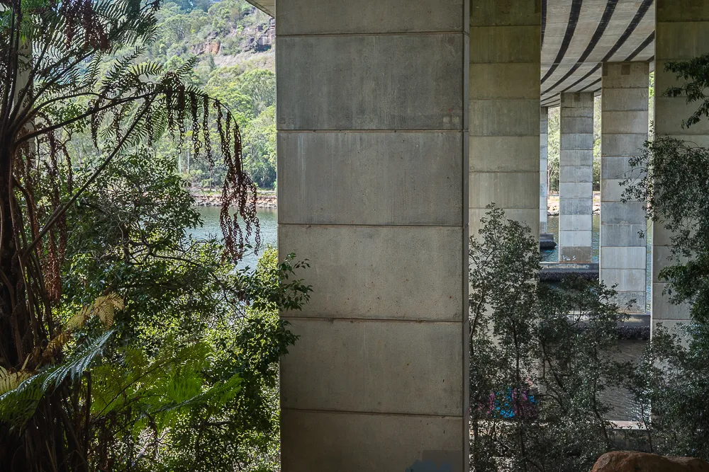
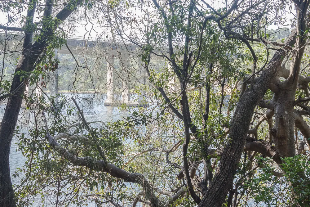
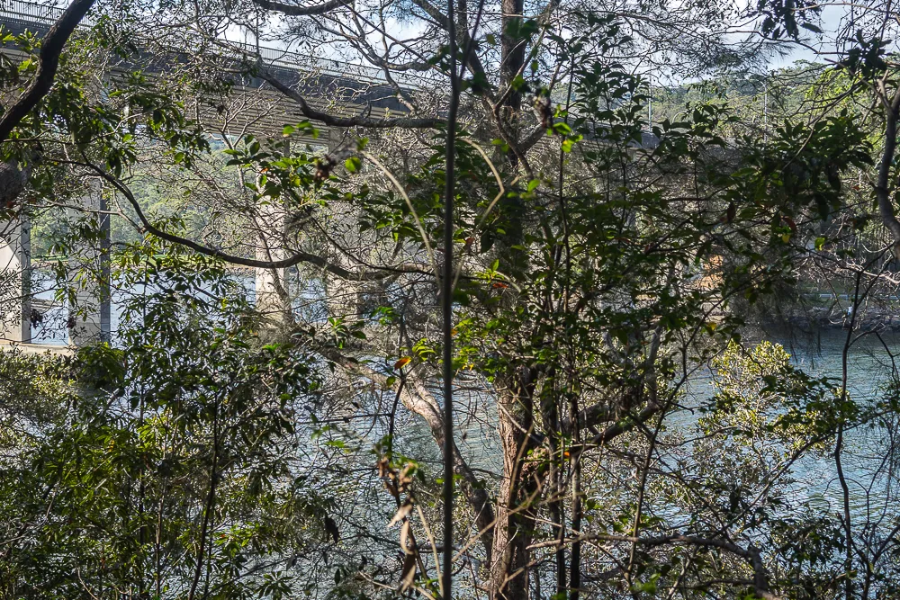
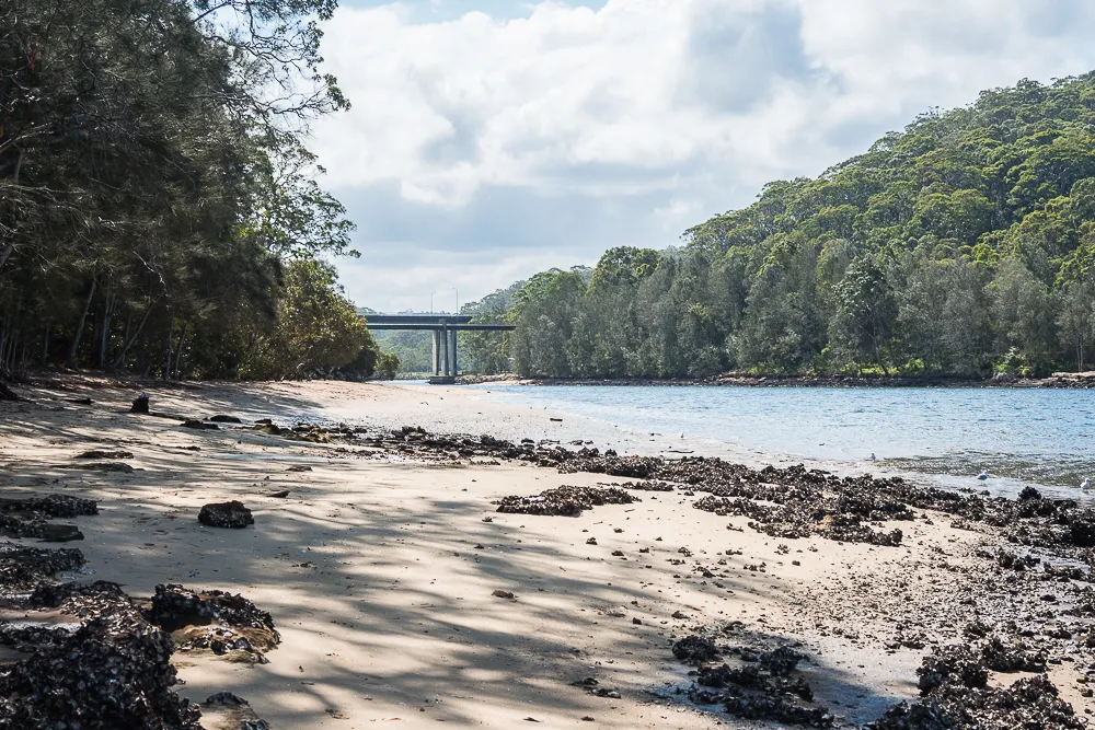
And now I'd like to take you along the section of the Two Creeks Track that leads down to the shores of Echo Point in Roseville Chase. Along the way we'll also loiter under the arches of the 'new' Roseville Bridge.
The 'new' Roseville Bridge is part of a major thoroughfare from the Pacific Highway at Roseville to the Northern Beaches and suburbs east of Sydney's Middle Harbour. This six-lane, high-level bridge was opened in 1966, replacing the original 'old' Roseville Bridge that had been built in 1924. Source: Roseville Bridge stands the test of time.
The Little Digger track follows the creek-bed of Moores Creek until it reaches the Two Creeks track. Although I'd been here once before with friends, I was now venturing into less familiar terrain ~ Alone.
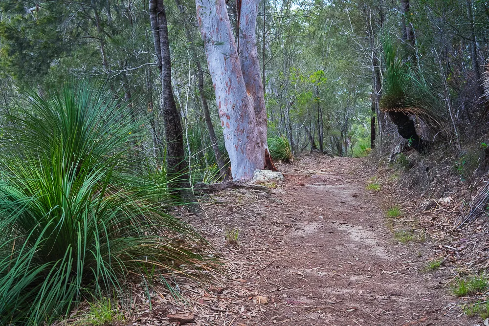
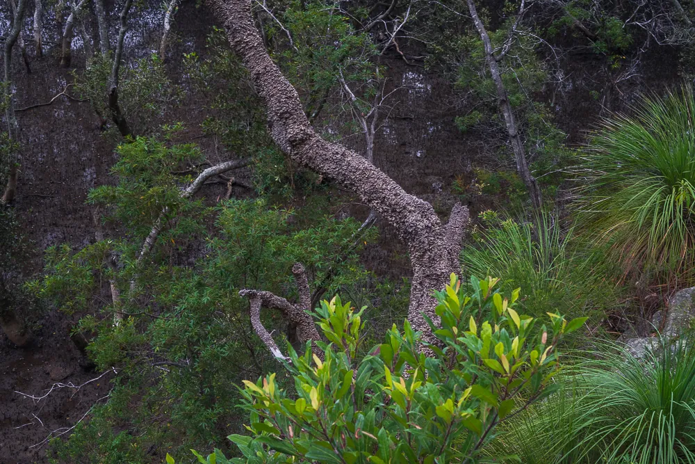
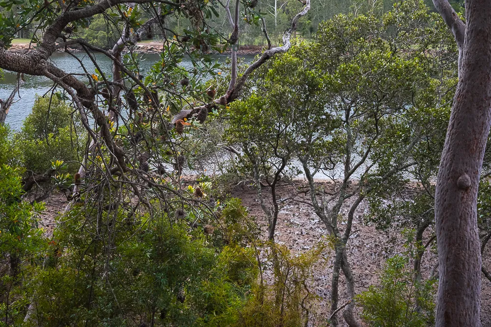
After photographing Bird's Nest Ferns, Stag Horns and Xanthorrhoeas along the tracks, I stopped for lunch on a rock outcrop that looked down through Banksia branches to the harbour mangroves. And had my first glimpse of the Roseville Bridge.
While thousands of commuters drive over Sydney's Middle Harbour every day of the year on the Roseville Bridge, very few would ever stop to think what lay beneath the bridge, let alone go there. So I hope you will enjoy these revealing images.
A brief History of the Roseville Bridge.
Before the first Roseville Bridge was built in 1924, the only way to cross Sydney's Middle Harbour was by rowboat.
If you didn't have a rowboat you could go to Smith's Boat-shed, where either one of the Smith brothers, Charlie or Joe would row you across for twopence. If you were on the opposite side you would simply COOEEEE Charlie or Joe and they would come over to pick you up. At dusk, a rowboat with oars was moored at either side ~ For emergencies.
Mangroves, the terrain of mud crabs reach down to the shoreline of most of Middle Harbour. And without a jetty, landing may have been rather challenging, particularly for refined ladies wearing long petticoat dresses. Fortunately there are a few small patches of sand and rocks, that passengers would have been able to safely navigate their way through.
The first Roseville Bridge was built in 1924 and became the first bridge to link the northern peninsula with the rest of Sydney: Eight years before the Sydney Harbour Bridge was opened. Source: Roseville Bridge the first to link the peninsula with the rest of Sydney
The 'new' Roseville Bridge was opened in 1966 and designed to blend aesthetically with the steep slopes of the harbour foreshores and give optimal views of the open expanse of the harbour.
I was particularly pleased to see that:
On the southern side of the bridge, the final meter of vegetation clearing was done by hand to avoid disturbance to the nearby bushland. Source: Roseville Bridge stands the test of time.
Great care was taken to preserve the surrounding natural environment during the building stage. ~Jonathan O’Dea.
The Roseville Baths.
The Roseville Baths were built on the eastern side of the Roseville Bridge. What a shame they're no longer there.
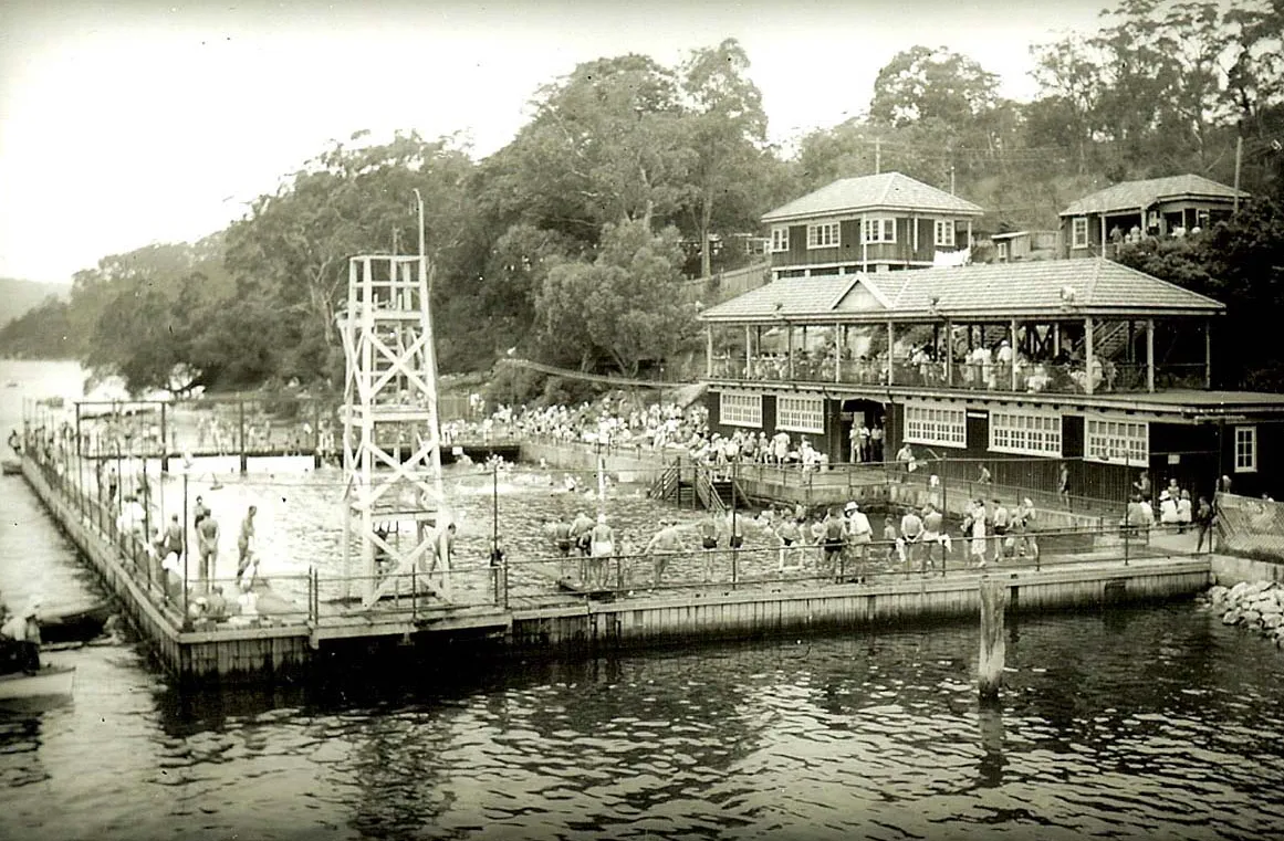
School Swimming Canaval. The Roseville Baths. 1952. Source: Ian Willoughby.
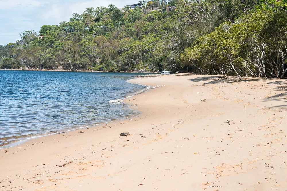
A little further on is a lovely sandy stretch.
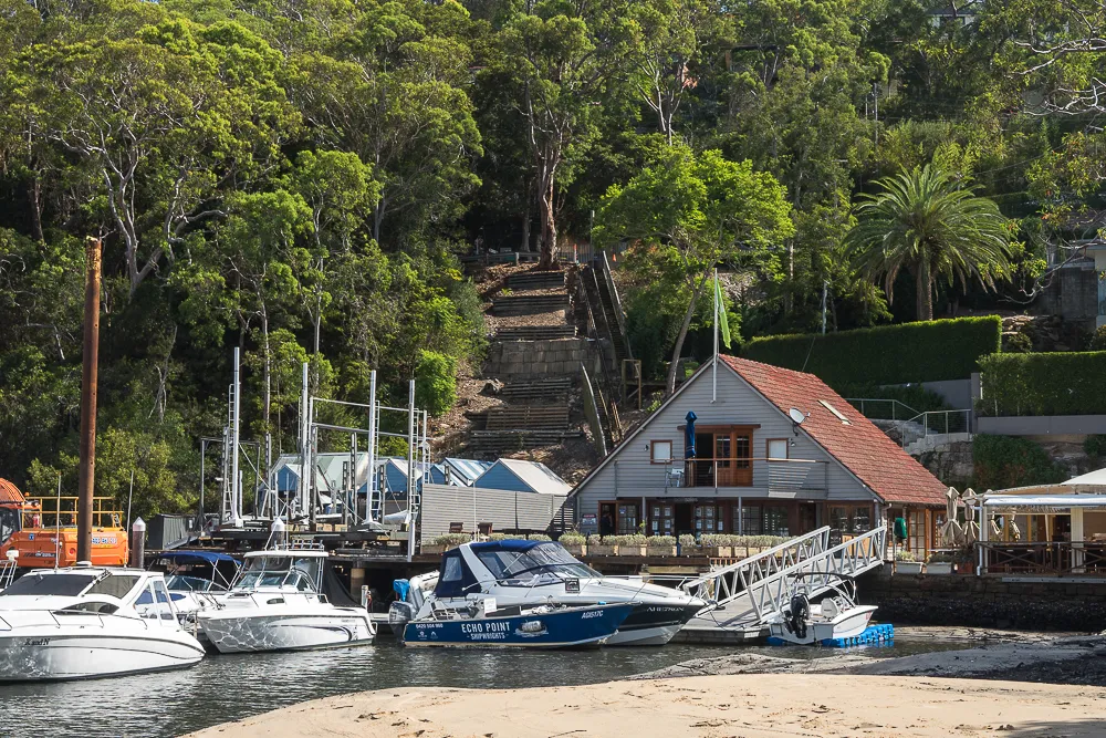
And around the corner is the Roseville Chase Marina and Echo on the Marina.
Echo on the Marina is the perfect venue for an outdoor breakfast or lunch. The looks over to the tropical vegetation of the escarpment on one side and the marina on the other.
Steps leading down to the marina and the restaurant pass through several spacious garden areas. Lovely soft green lawns, even in the middle of summer with ample shade for picnickers. And for trekkers like me to have a late afternoon siester.
In another article I'll invite you to meet one of my most beloved bush beings: The Xanthorrhoea.
SONY Mark2 A7: 35 mm:

All works are licensed under a Creative Commons Attribution-ShareAlike 4.0 International License
Terms of CC BY-SA.
This ShareAlike license will allow you to reproduce and/or manipulate this image even for your commercial purposes.
You are required to attribute me, Alison Lee Cousland as the designer/artist.
You also need to be willing to license any of your new creations that make use of this image, under the identical terms IE allow others to reproduce and/or build their own art upon your art, as well as granting their right to commercial usage.