
Though I have a fairly healthy vocabulary, I had never heard of the word “exclaves” before. If I ever knew it, I must have forgotten its meaning until reading recently about Point Roberts, Washington. As one would guess, an “exclave” is distinctively different from an “enclave.”
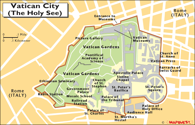
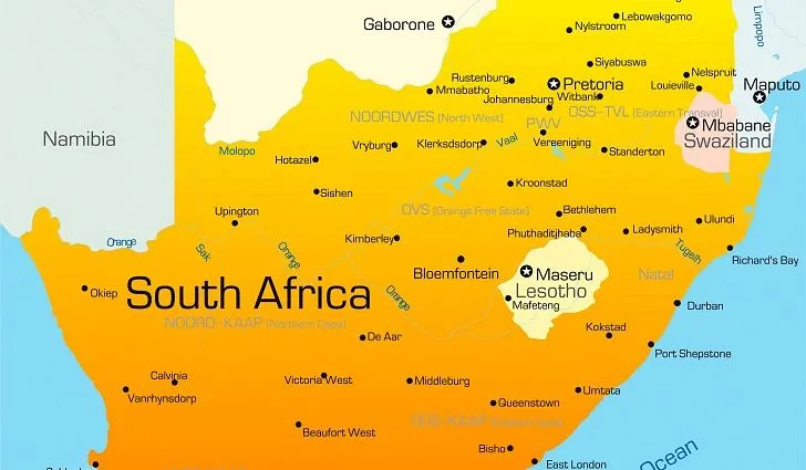
An “enclave” is a territory, or part of one, that is inside a foreign territory. One example was West Berlin under communism. Berlin and the surrounding area were solidly situated in Soviet-controlled East Germany, but West Berlin was controlled by the other Allied powers after World War II. The Kingdom of Lesotho, a sovereign state which sits entirely within the nation of South Africa, is another example of an enclave. The Vatican City and San Marino are others, and there are numerous additional territories (if not sovereign nations) that exist within the borders of various countries.
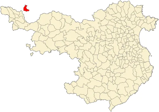
But what about “exclaves”? It’s a similar concept in which the mainland territory of one state is completely surrounded by the territory of another. Think of Llivia, a town that is formally part of Catalonia, Spain, yet is which situated within the imprint of France. Llivia is approximately 1 mile (1.6 km) from Spain, and to get there, people need to go through the French administrative region of Pyrenees-Orientales.
Another example is the Likoma and Chizumulu Islands in Lake Malawi. These islands are situated on the Mozambique side of the lake, just off its shore. Yet the islands belong to Malawi, the country on the (far) other side of the lake.
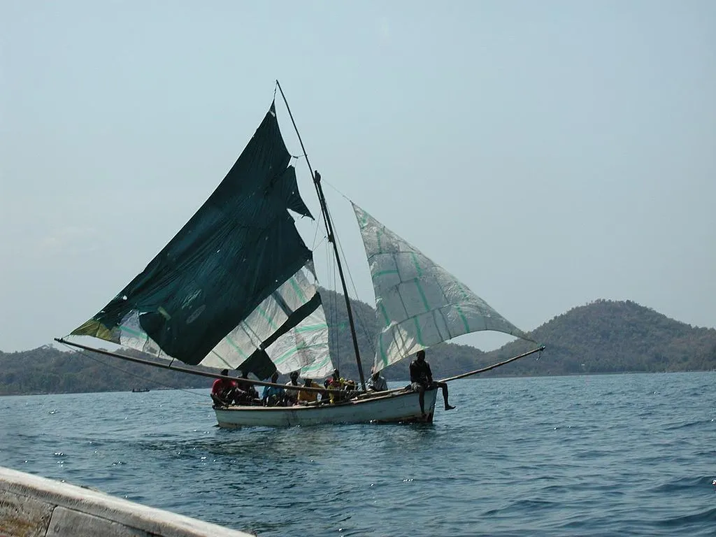
Likoma Island on Lake Malawi. Source: Creative Commons via Flickr.com by fffriendly.
Most often, there is either a quirk of geography or some historical reason that a particular place was strongly identified with the country in which is resides. Therefore, even though its imprint is in a foreign country, it was not ceded to that country. In the case of Llivia, for instance, it was too small to be considered a town and thus was not included in a historical treaty that might have granted it to France.
The U.S. state of Alaska qualifies as well. It is disconnected from the lower 48 states, connected instead to Canada and its western provinces of British Colombia and Yukon. Alaska’s reason for being part of the United States is because the U.S. purchased it from Russia in 1867 for a price of $7.2 million. I’m guessing Russia wouldn’t do that deal again today.
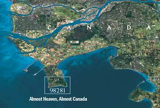
The word “exclaves” came up when I was reading something about a place I once visited, the community of Point Roberts, Washington, part of the United States. There are several places along the length of the U.S. Canadian border that qualify as exclaves, including similar communities in Minnesota and Vermont. They are officially part of either the U.S. or Canada but isolated from their home country by another country due to a quirk of geography or history or both.
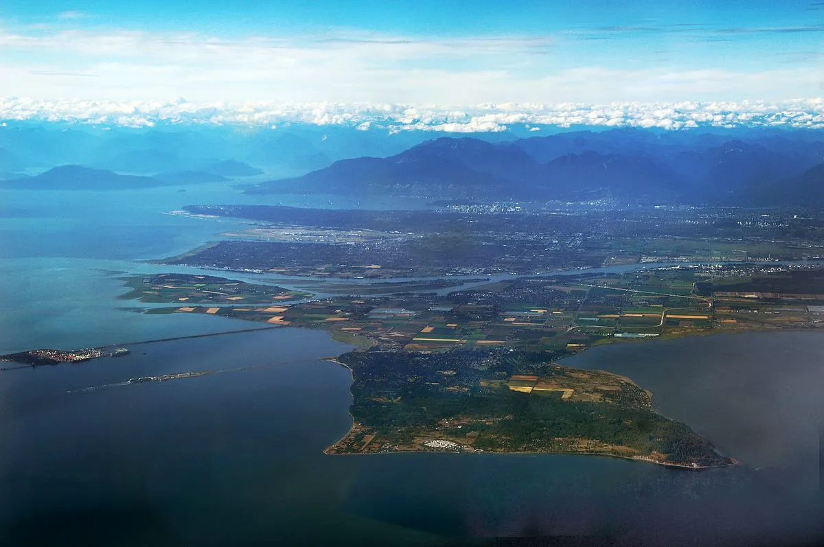
South of Vancouver, British Colombia, Canada, the Tsawassen Peninsula extends into Boundary Bay and the Strait of Georgia, a waterway that continues from Canada into the United States. In the 19th Century, the U.S. and United Kingdom (which then administered Canada) settled a border dispute with something called the Oregon Treaty. That treaty simplified border claims in this region by drawing a line at the 49th parallel.
Problem: the 49th Parallel runs to the north of Point Roberts. That means that it is technically in the United States, even though it is at the end of a Canadian peninsula, surrounded otherwise only by water. So today, its 4.884 square miles (12.65 square kilometers) and 1,314 residents are part of the United States. There is air and water access to Washington in the U.S. to the south, but anyone travelling across land from Point Roberts must do so by driving through Canada.
As a child, I remember my parents taking me across the U.S. Canadian border from Seattle into Vancouver and we stopped in Point Roberts also. Why? For some reason, it was important to my father and he wanted to explain to me the historical reasons why it was a part of the U.S., but located in Canada. Look, Dad, it worked; I’m still interested enough in this quirk to write a post about it.
References
https://en.wikipedia.org/wiki/List_of_enclaves_and_exclaves
https://en.wikipedia.org/wiki/Enclave_and_exclave
https://en.wikipedia.org/wiki/Ll%C3%ADvia
https://en.wikipedia.org/wiki/Likoma_Island
https://en.wikipedia.org/wiki/Point_Roberts,_Washington
Top image: Creative Commons via Wikimedia.com by madereugeneandrew. Last image from bellingham.org. Others, unless credited separately, believed to be public domain.