
Hello, this is the third part of my story about the journey to the Aral Sea, which I made in September 2018. The first part was devoted to Sudoch'e Lake, the second part directly to our stay on the Aral Sea coast, and in the third part I will tell you about the Ustyurt Plateau.
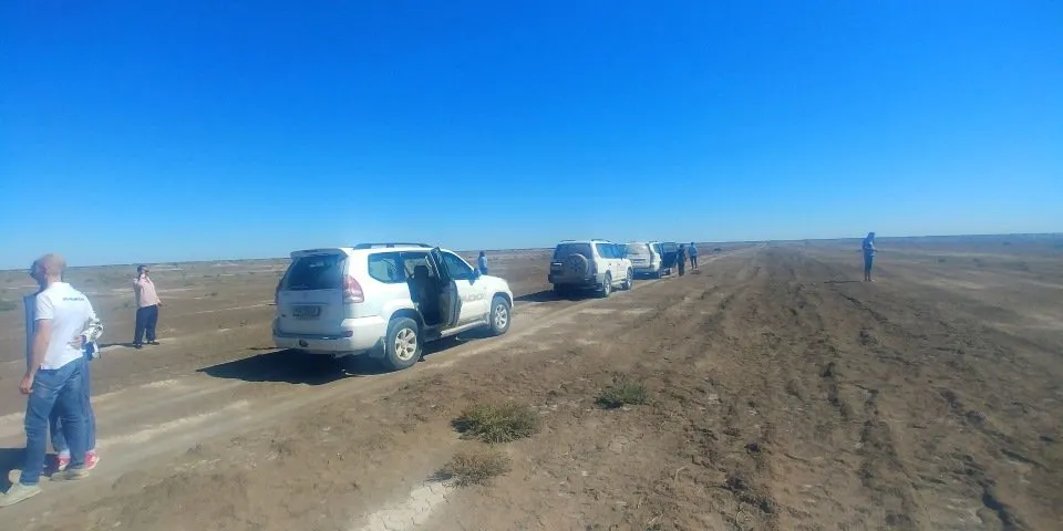
After admiring the sea, we loaded into our SUV and went on a many hours journey on the Ustyurt plateau.
The plateau occupies an area of more than 200 thousand square kilometers and is located on the territory of three countries - Kazakhstan, Uzbekistan and Turkmenistan. On satellite photos, this is a huge desert that lies between the Aral Sea and the Amu-Darya River.
Previously, on the territory of the plateau were carried out the tests of both chemical and nuclear weapons. Underground nuclear explosions were carried out in the territory belonging to Kazakhstan.
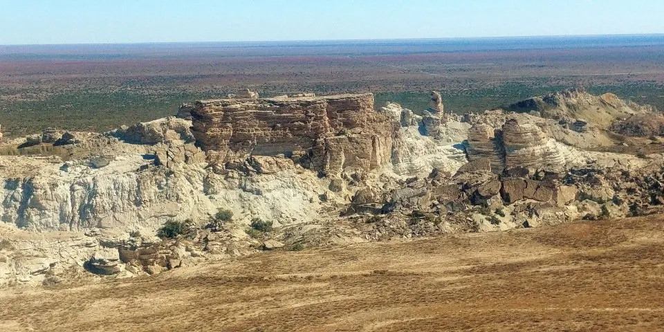
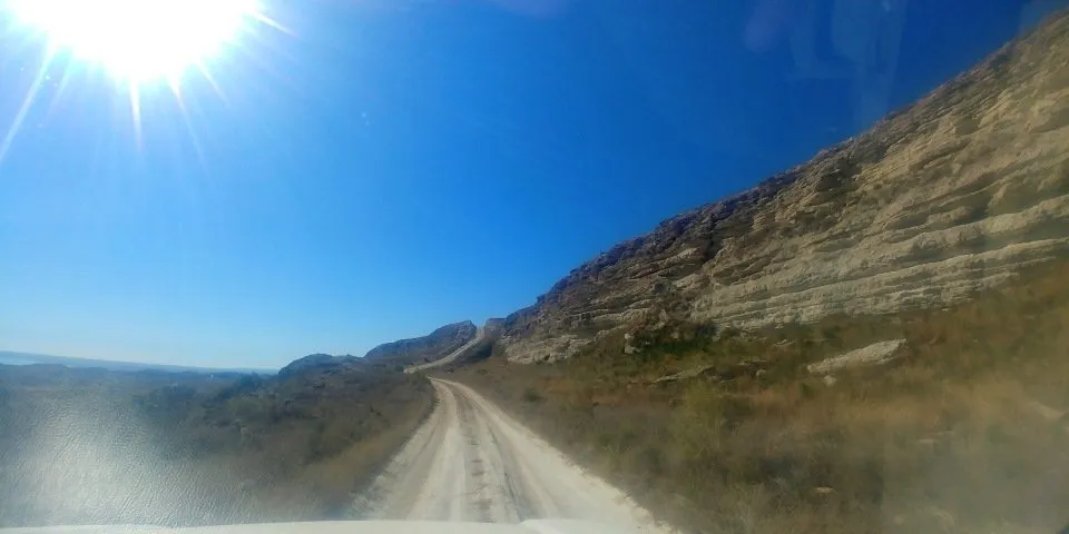
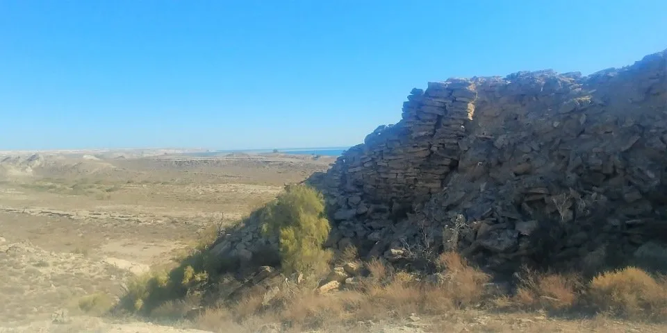
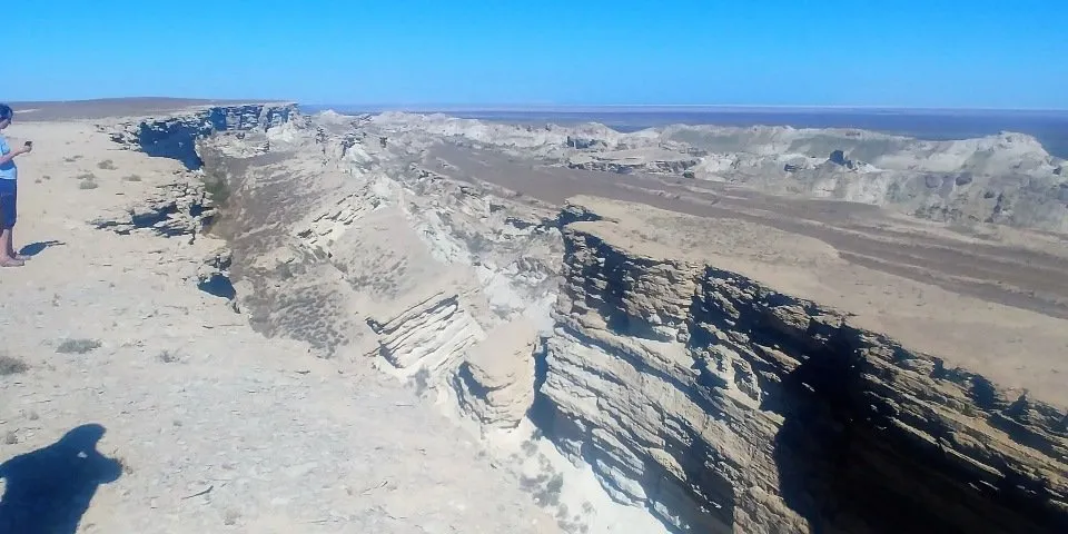
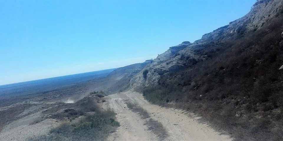
Once the coast of the plateau washed the ancient sea. In the photo below you can see that the road goes along the natural wall. In fact, we drove along the bottom of the dried sea and the wall on the right is the former seashore. This wall is called the "chink" - the steep edge of the plateau, when it was the seashore. It consists of many layers consisting of limestone and chalk. Among them are fossilized remains of marine sediments. Below there are photos where there are multicolored pillars of chink.
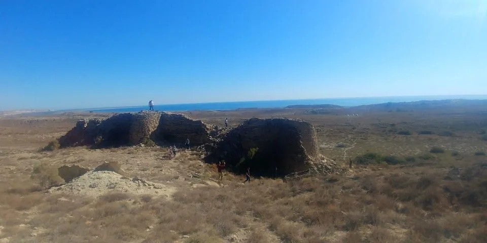
But we will get to them. In the meantime, we went to see the ruins of an ancient caravanserai built in the XI-XIII centuries. Trade routes of the Great Silk Road passed here beforea and there were ancient settlements but the Amu Darya changed its course and people left these places. In general, this part is little studied by archaeologists. We can say that they have just begun to explore these places.
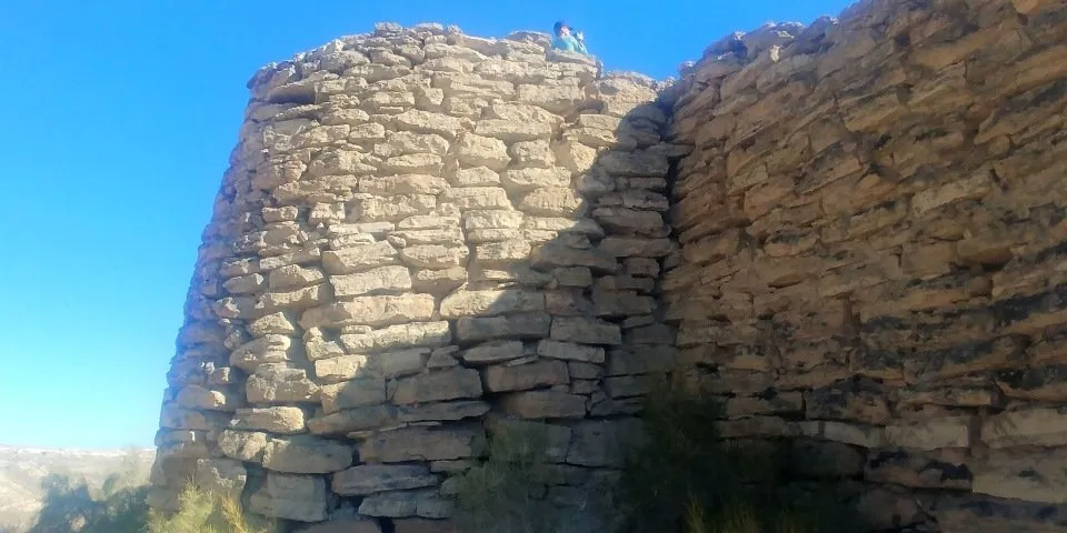
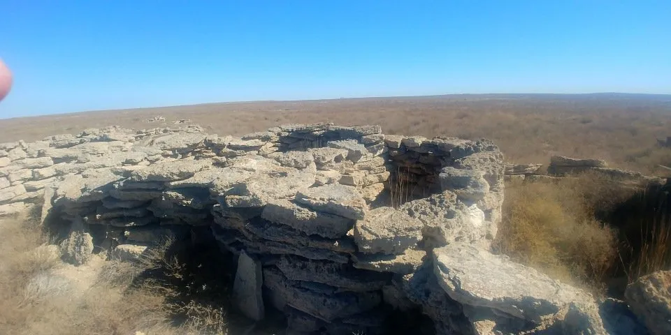
According to our drivers, we were brought to the ruins of an old caravanserai, but it is quite possible that it was a fortress or the house of some wealthy merchant who preferred to live on “first line by the sea”. As seen in the photographs, the walls of the building are very thick, made of flat stones.
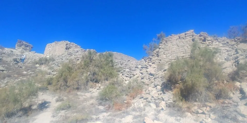
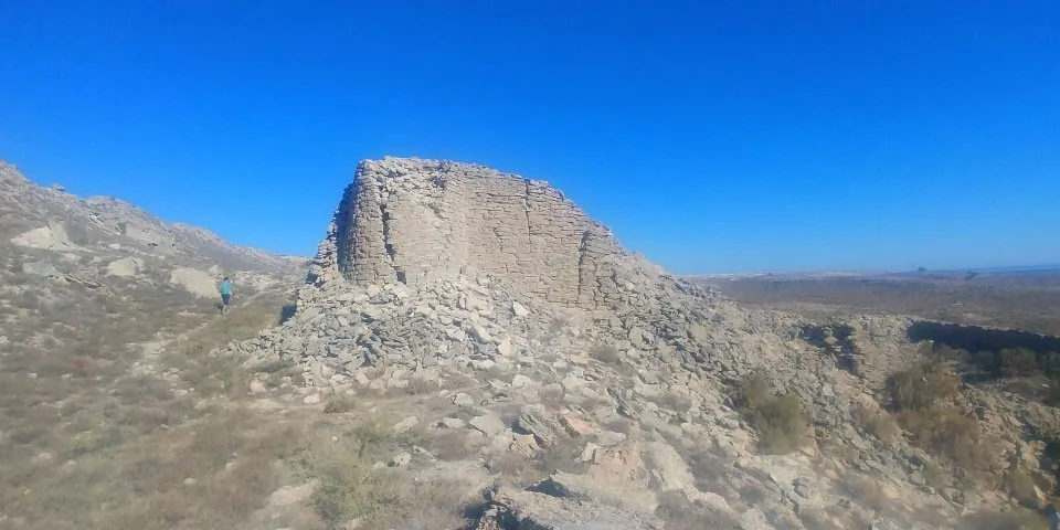
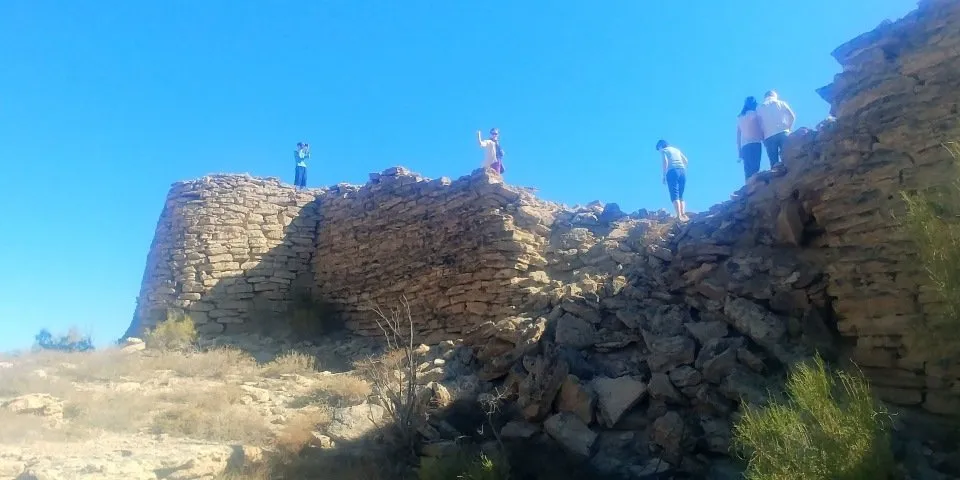
On the sides are pretty powerful towers.
Unfortunately, I don’t always remember what the guides say as I often find myself fascinated by photographing the sights and often miss their words. In the case of famous historical sites like Samarkand or Bukhara this is not a problem. In those cases I can google the information. But here there was a difficulty - there is very little information on the sights of the Aral Sea and the one that is not very informative. We have to strain our memory and remember what the drivers told us. But nothing, little by little, our historians and archaeologists will get to these places.
After the caravanserai we drove to the canyon, visiting the old cemetery on the way.
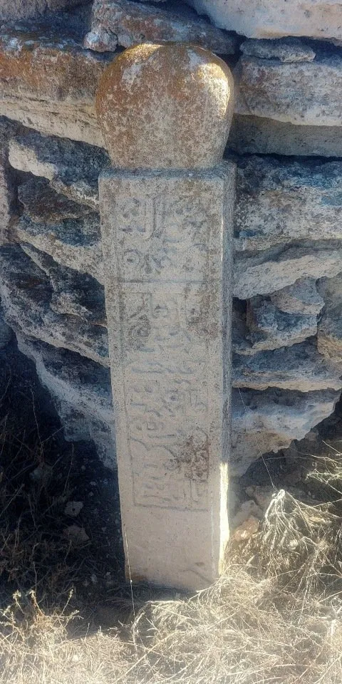
This is an old and abandoned cemetery of the XIV-XV centuries, and if I am not mistaken it is Kazakh cemetery.
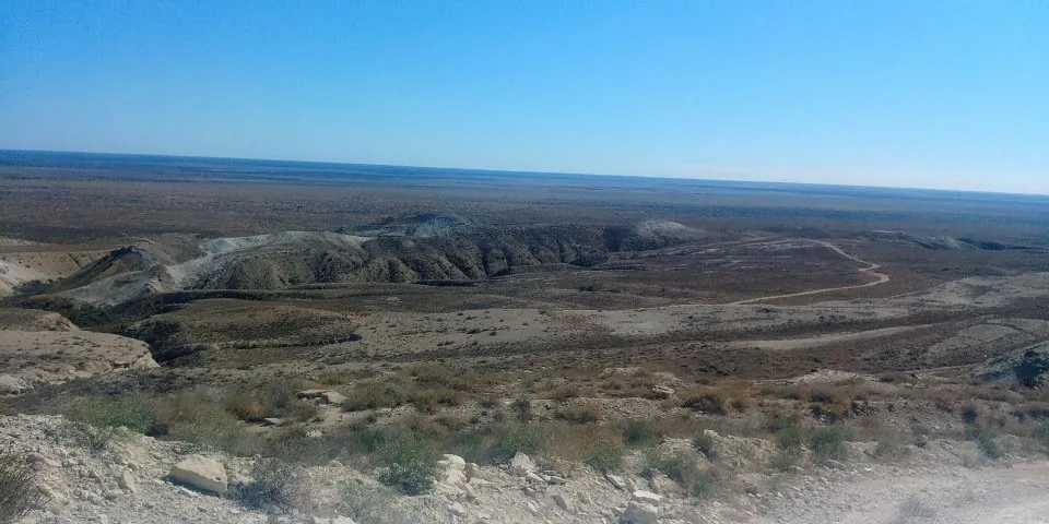
After that we went to the side of the canyon. The terrain was flat as a table and the drivers managed to accelerate to 100 km / h. So, we quickly reached the canyon. Got out and were stunned ....
The harsh and majestic beauty of this place is difficult to describe in words. And the possibilities of my camera also can not reflect it fully. Here you have to go live, stand on the edge of the plateau, breathe the air and feel the aura of this place.
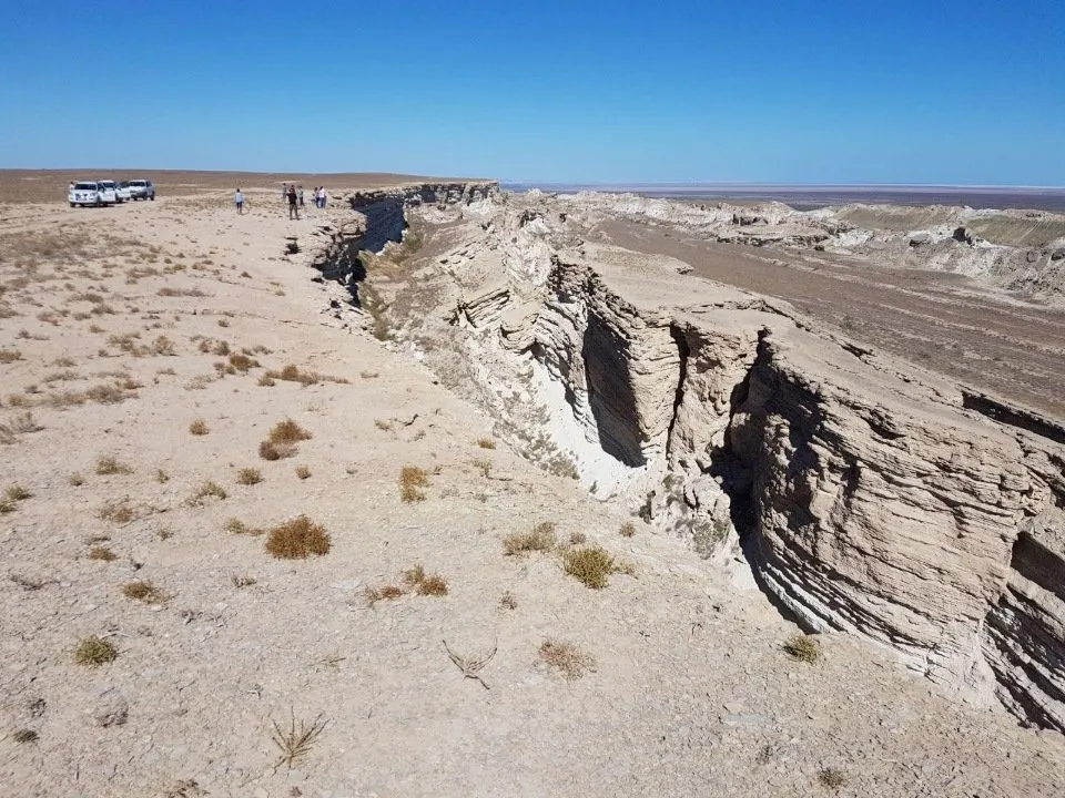
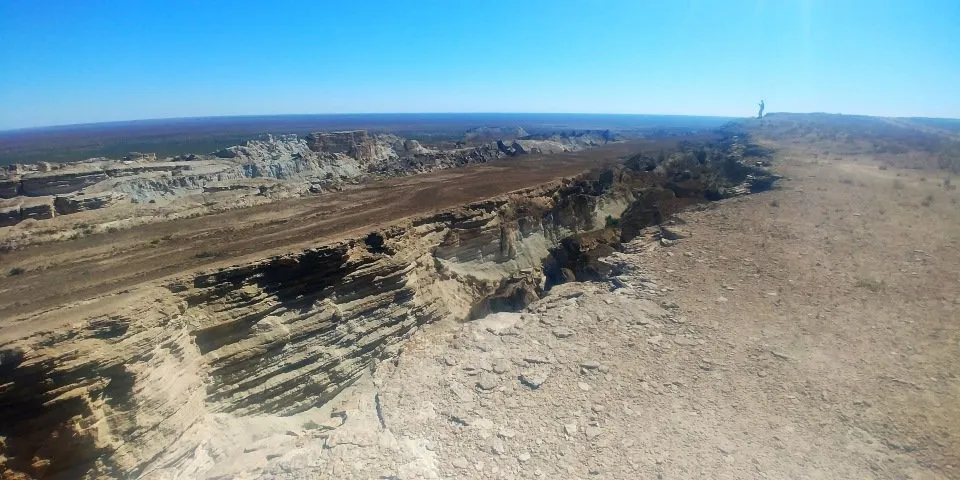
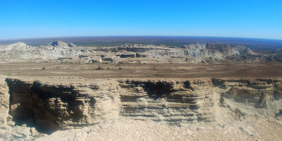
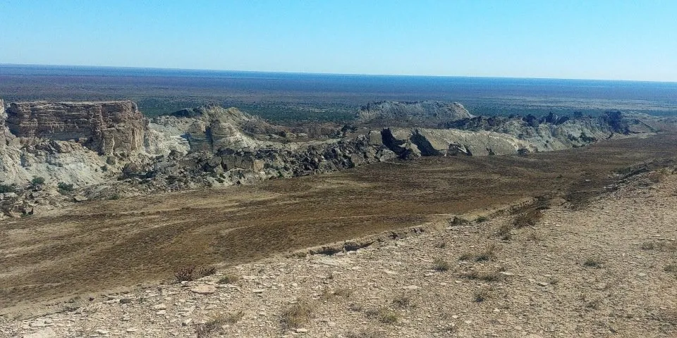
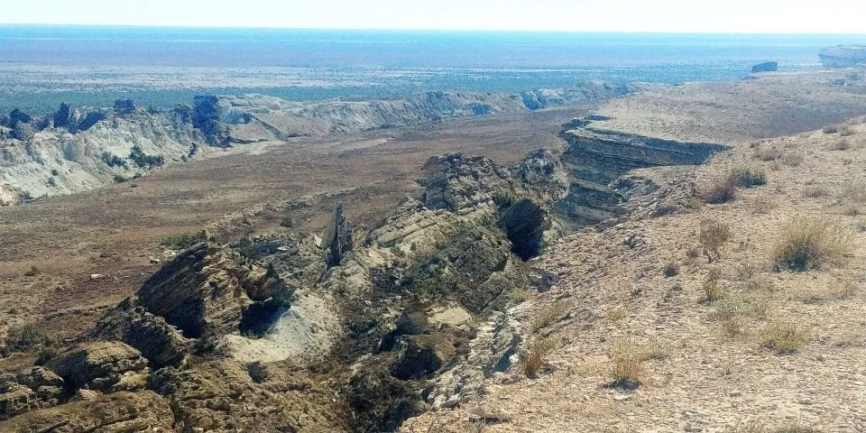
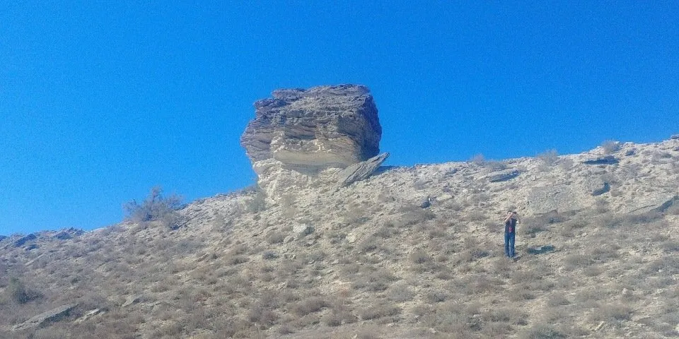
Here, strong winds constantly blow, cutting out amazing pillars and towers from a chink.
I do not know how many time we spent here, but iwe were forced to move on. We again descended from the plateau to the bottom of the former sea and went to the city of Muynak in order to see the ship graveyard.
On the way, we stopped a couple of times to take photos.
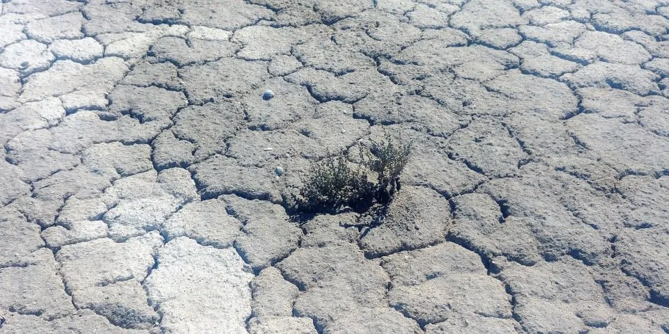
The vegetation here is not the most diverse, but tenacious. It breaks through the dried and salty soil.
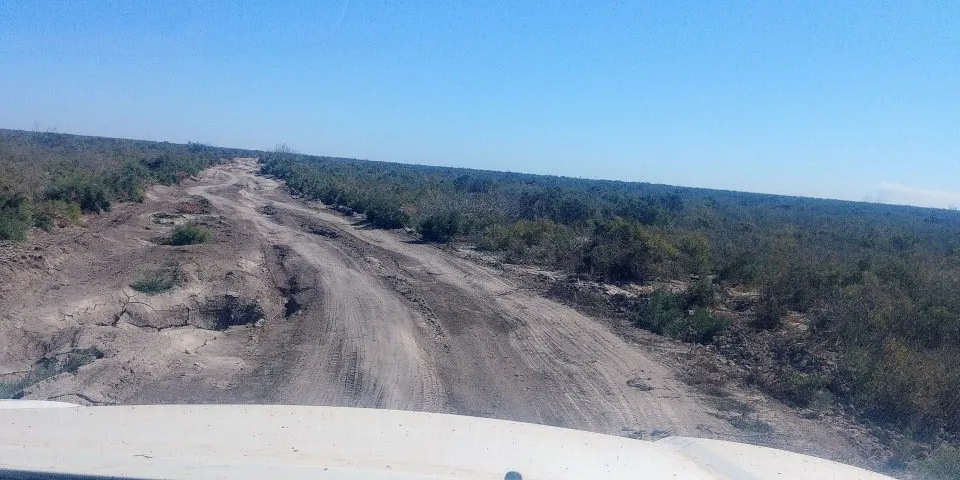
Soon the smooth road was replaced by such bumps, and we significantly slowed down our speed.
Closer to dinner, we got to Muynak. After a delicious lunch in a private house, we went to the ship graveyard, which is located on the outskirts of the city. My next photo report will be about this place.

!steemitworldmap 44.163935 lat 58.797822 long Journey to the Aral Sea. Part 3. Ustyurt plateau. d3scr