
Day Thirty: As was expected, at the close of Day Twenty Nine, the sun rose on a new day, but was hidden from view. Under a thick bank of clouds in the early stages of ... snowing ... some more ... 😞
Okay! That settled it for me, as you will read in more detail below. This would be my final day "out on the road!" Good bye winter traveling. 👋 I was homeward bound.
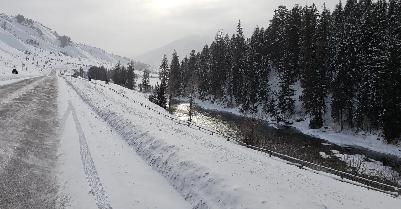
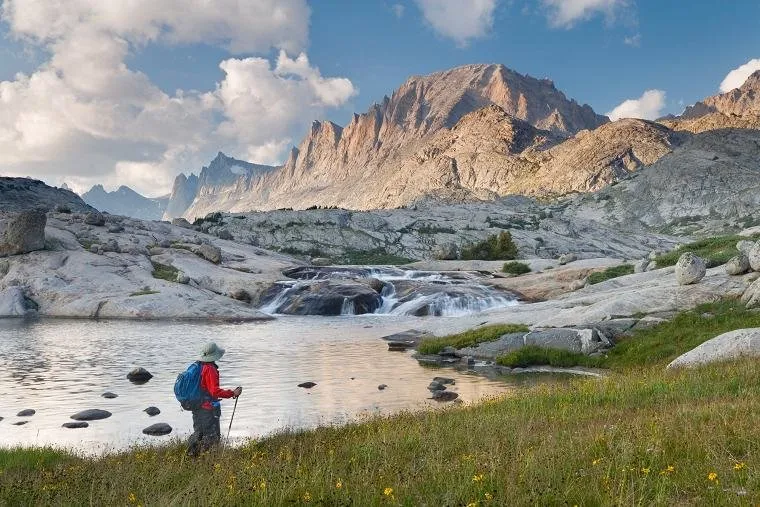
Photo: Hoback River in Wyoming
I did still enjoy some nice wintry scenery, as well as the opportunity for some more reflection and reliving memories, while traveling in Wyoming.
Please "walk with me," dear reader, through this final day of creating lifetime memories ...

Spirit of America's Pioneers
The introductory image, for this final day of my "road to recovery" posts, is from the beautiful Hoback River in Wyoming. I took this picture about an hour after leaving Jackson Hole.
While the sun did not break through, at least it was casting some light down on this nice river, through a "thin spot" in the cloud cover.
So ... Who was this river named after? What was this person's "story?"
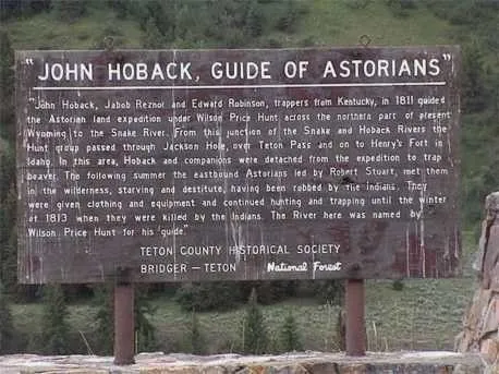
Source: Pinterest - Rich Hoback, a Descendant
- Note: True confessions, I stopped and took my own picture of the sign shown in the photo above. For the life of me, I have no explanation, upon arriving home, why it was gone from my phone. I am indebted, therefore, to the family history work of Rich Hoback, a descendant of John Hoback, for posting it on his Pinterest page!
The river was named after John Hoback, an American pioneer of sorts. Or alternatively, he was called a mountain man!
Here is what is listed on this historical sign, about the man for whom this region of Wyoming is named:
"John Hoback, Jacob Reznor and Edward Robinson, trappers from Kentucky, in 1811 guided the Astorian land expedition under Wilson Price Hunt across the northern part of present Wyoming to the Snake River. From this junction of the Snake and Hoback Rivers the Hunt group passed through Jackson Hole, over Teton Pass and on to Henry’s Fort in Idaho. In this area, Hoback and his companions were detached from the expedition to trap beaver. The following summer the eastbound Astorians led by Robert Stuart, met them in the wilderness, starving and destitute, having been robbed by the Indians. They were given clothing and equipment and continued hunting and trapping until the winter of 1813 when they were killed by the Indians. The River here was named by Wilson Price Hunt for his guide."
Long fascinated by the stories of the "adventures" of times past, I have wondered at times if I was born at the right time in history (not up to me, of course, but I have thought about it ...). There is something about the challenge of what those people faced that is inspiring.
Inspiring in that they met the challenges of their time and place in history and rose above it! Not all of them, as we read in this brief biographic glimpse into this one man's story But those who came after did not forget to credit their success to those who had come before them. They remembered and honored their efforts.
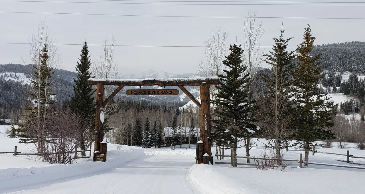
Photo: Hoback River Ranch in Wyoming
How many pioneers live to see what comes from their efforts? Beautiful places like this are seldom built from scratch out in the middle of nowhere. They are built "on the backs" of those who came before them. Their triumph over obstacles making achievements like this possible.
These contemplative thoughts were with me for quite awhile, as I rode on through the day on wind-swept, snowy roads. I have seen many places on this trip. And a lot of historical references to similar adventures and achievements. For example, like the Lewis and Clark Expedition. Or John Mullan, who came after them, and led efforts to built roads through the wilderness, long before the Civil War.
All thoughts riding along in the relative comfort of my trusty little 4 X 4 Ford Ranger. On a paved highway ...
Traveling in Wyoming
So, "walking with me," through the day, I was up early on Day Thirty. In looking out the front door of the Airbnb residence, in which I stayed ...
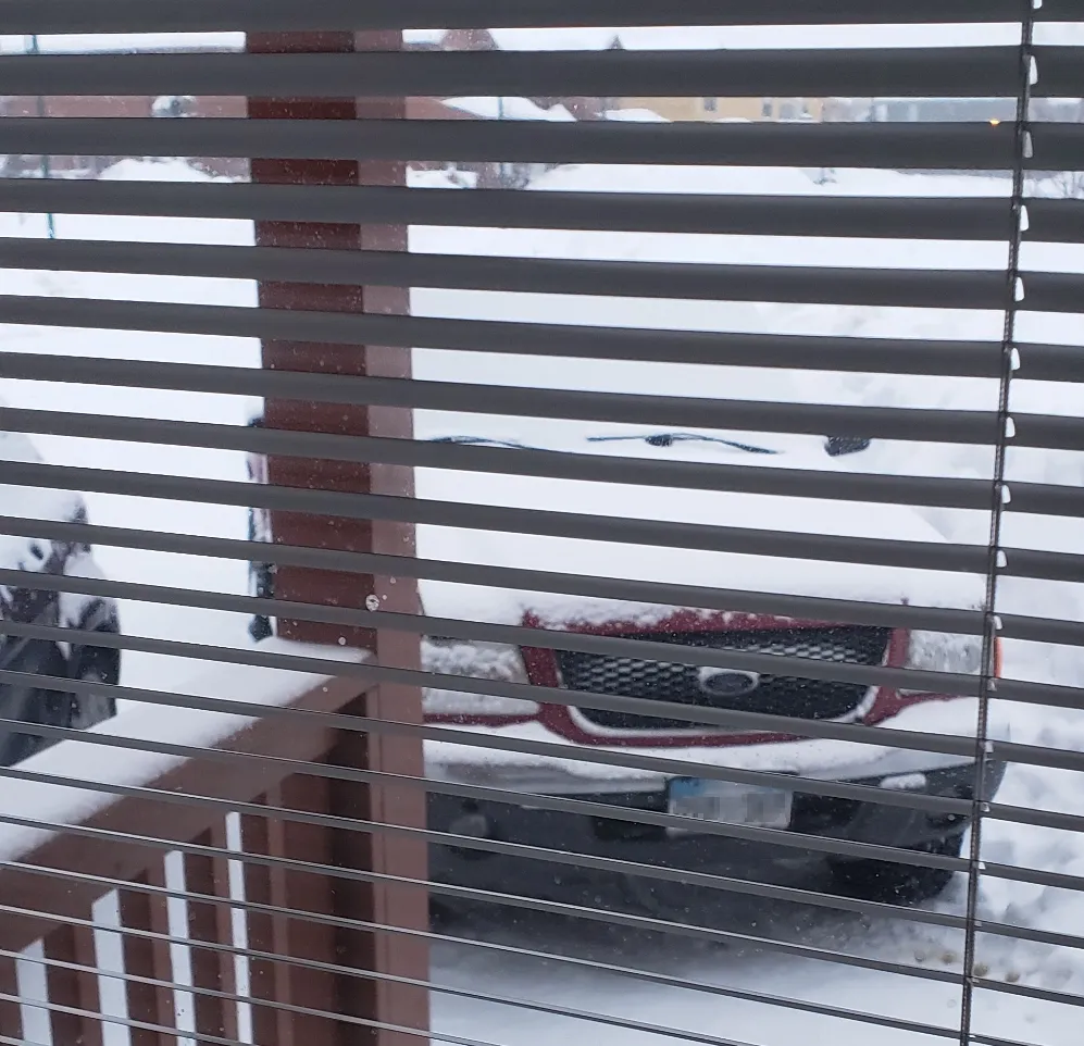
Photo: Day Thirty Begins ...
... I was greeted with this view. Backed up by a current temperature of -1°F (-18 °C) and the chance for more snow being 65 % for the rest of the day.
So ... I made up my mind very quickly on what the final day of "roleerob's excellent adventure" would be. Focusing on being thankful for what I had experienced rather than the disappointment of not seeing the Grand Tetons, I would set out for home.
While a little farther away than originally planned and no idea what I would be facing driving in Wyoming, I was resolute ... "Do whatever it takes" and finish the trip ...
As if I needed it, once "out on the road" I had my decision quickly reinforced ...
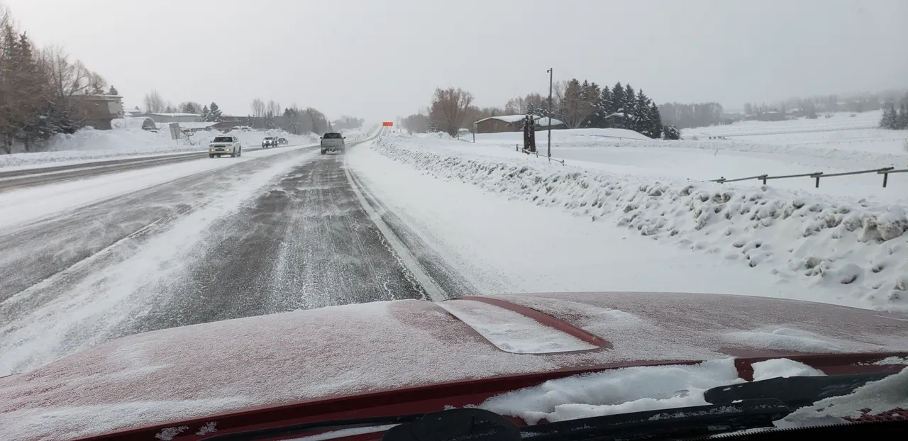
Photo: Leaving Jackson Hole, Wyoming
... as the ceiling of the cloud cover was very low. It was "snowing and blowing," which is pretty standard for the State of Wyoming. Especially the "blowing" ... 😉
Here is the route followed, for the portion of the day's travel covered by this post:
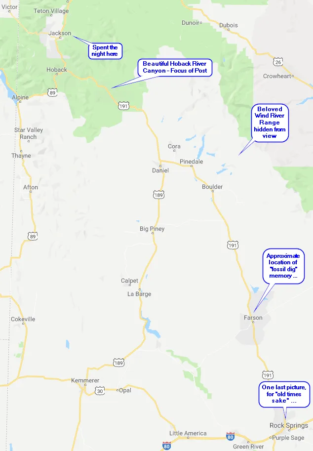
Illustration: Travel Route for Day Thirty Post
What you cannot see on this map is that the very first part of the trip, out of Jackson Hole, is along the Snake River. Yes, dear reader, the same Snake River that I last saw two days earlier, at the "seaport" of Lewiston, Idaho. At the confluence of the Snake and Clearwater Rivers ...
Here I was driving along what is flowing down from its headwaters out of the mountains around Yellowstone National Park. It is a beautiful river here and one of the great rivers of the western United States.
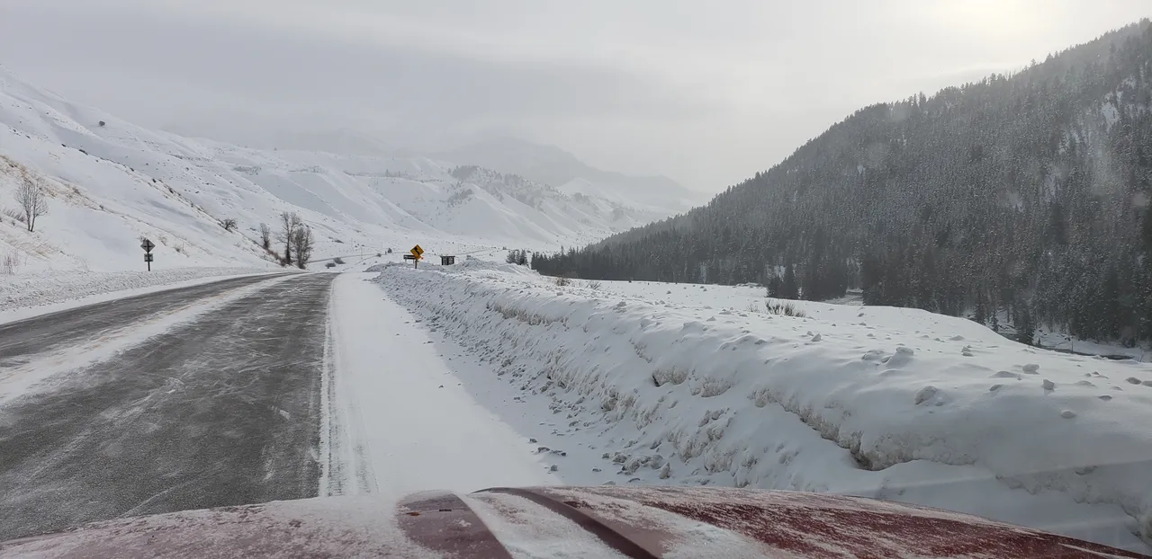
Photo: Hoback River Canyon on US Hwy 191 in Wyoming
Turning up U.S. Highway 191, I was climbing up through the Hoback River canyon, as referenced earlier. By the time you emerge out the top of the canyon, headed into Pinedale, Wyoming you are driving at elevations over 7,000 feet (2,134 m)!
Taking a quick look back, in reaching this point, since leaving the Lewiston, Idaho area earlier, at an elevation of 745 ft (227 m), I had crossed:
- Lolo Pass - 5,233 feet (1,595 m) in elevation.
- Lost Trail Pass - 7,014 feet (2,138 m) in elevation.
- Big Hole Pass - 7,400 feet (2,256 m) in elevation.
- Teton Pass - 8,431 feet (2.570 m) in elevation.
So ... All along the way I had been steadily climbing ever higher. In the wide open plains of Wyoming, you can appreciate that you are in the state highest in elevation in the United States. Technically, it can be researched and you will find that honor being given to Colorado, due to its numerous +14,000 foot peaks.
But ... I have traveled extensively through both states and the wide open spaces of Colorado are just not as high collectively as they are in Wyoming. Take my word for it ... 😉
Once cresting over the ridge between the Hoback River canyon and the basin in which the town of Pinedale lies, I was chagrined to see that my beloved Wind River Range was also completely hidden from view. In my years of backpacking and enjoying back country adventures, nothing has been better than times spent in these mountains.
I can't click "Publish" on my final R2R post, without you having an idea of what these spectacular mountains are all about:
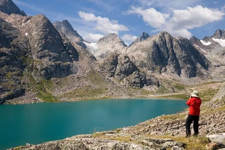
Source: Visit Pinedale - "All the Civilization you Need" ...
There you have it, dear reader, a brief glimpse of the incomparable Wind River Range of Wyoming ...
I crossed the Green River, which drains the whole western side of the Wind River Range and becomes the largest tributary of the Colorado River, at their confluence further south in the State of Utah. I stopped briefly in Pinedale for a nice belated breakfast, then moved on ...
Photos: Wide Open Country on US Hwy 191 North of Farson, Wyoming
These photos taken north of Farson show the sun finally breaking through a little bit. To shine down on a vast stretch of open country, where at first glance it would appear there is a lot of nothing out there.
- Note: In the distance, on the left of the lower photo, you will see the tell-tale tower of a drilling rig. Recent advances in American technology, leading to our country now being the largest exporter of oil and gas in the world, have led to a lot of employment in exploring these vast reaches of Wyoming ...
Well, for sure, there are very few people. But, it brought back memories of long ago, when I worked as a laborer, based out of Rock Springs, Wyoming. After hours and on weekends, I worked for a man who was a specialist / expert in local fossils. Over the years, he had developed an extensive network in the East for selling them, so it was quite lucrative for him.
Somewhat elderly, he hired me to dig them up for him in an area just a few miles from where these pictures were taken. I will never forget digging down to "bedrock" 8 to 12 inches (20 to 30 cm) below the surface. This "bedrock," however, was unlike anything I had ever seen. It was a sedimentary bed of rock laid down in layers, at the bottom of an ancient sea (according to this expert ...).
Once exposed, you could peel back the layers of the rock, much like leafing through the pages of a book. Pressed in between these "pages" of rock, you would find a significant number of different types of fossils. Overall, there were a surprising number of them, although some types which much rarer than others. Great memory ...
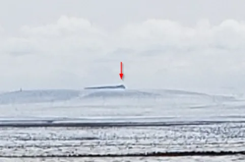
Photos: Looking South on US Hwy 191 to Pilot Butte, Wyoming
South of Farson, on U.S. Highway 191, I could see the famous Pilot Butte, which served as a major landmark along the Oregon Trail spoken of in an earlier post.
In my time living in the area, I climbed to the western high point a number of times. This was back in the 1970s , in the "wild west" (pretty literally ...) days of Rock Springs, Wyoming. At the time, I could see all the way down to the Uintah Mountains on the border of Utah and Wyoming and up north to the great Wind River Range. And a long, long way east ...
In those days, there were plentiful herds of both horses and antelope. I could sit up there for hours, just watching distant thunderclouds move across the prairie, and closer up the horses and antelope in herds down below. It really was a magical place. I have not been up there since the 1980s, so no idea what it is like today, although I imagine the distances you can see are largely unchanged.
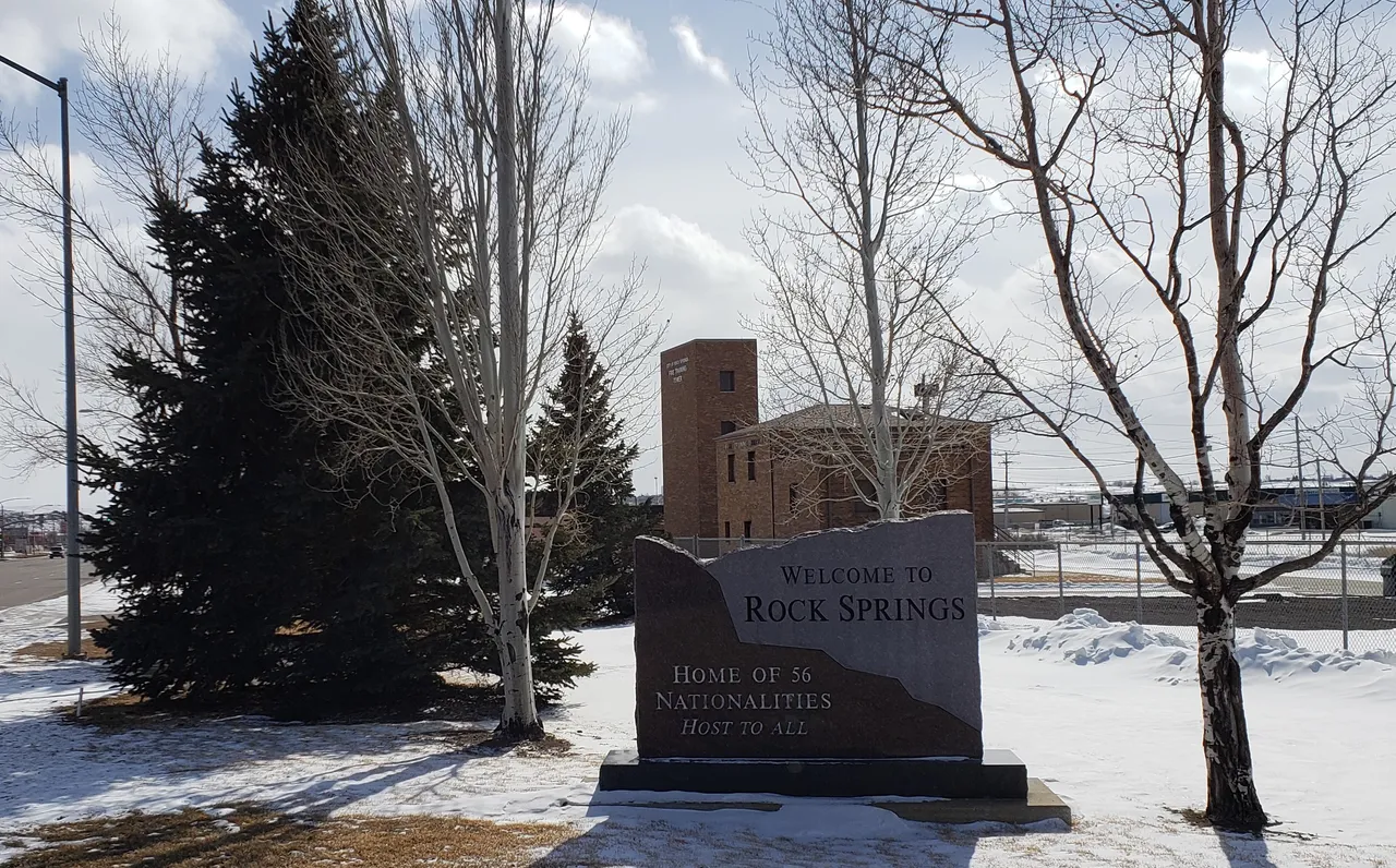
Photo: Town of Rock Springs, Wyoming
Entering Rock Springs, I was struck by this sign claiming this incredible number of nationalities represented here. I really don't know what that is about, as certainly no claim like that could have been made when I lived there in the 1970s.
This town holds some vital memories for me, as it was here I learned "up close and personal" about the corruption of the union movement. It changed my life. Having dropped out of college a couple of years earlier (long story), I might have stayed in this industry for all of my working years. Yet, the impact of my experiences provided all the motivation I needed to return to college.
With a vengeance and a much clearer purpose.
I subsequently graduated with a degree in Metallurgical Engineering and never looked back. A major "Y in the Road" of life where there has never been any question as to whether or not I made the right decision ...
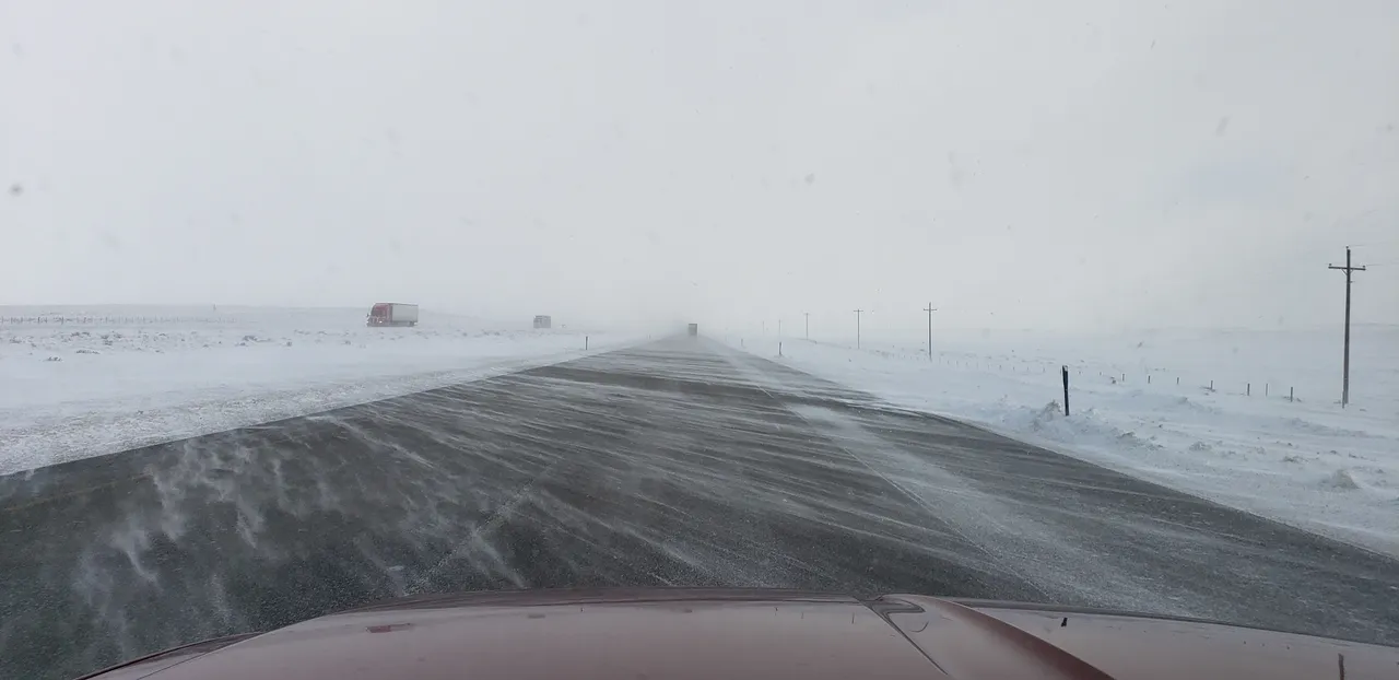
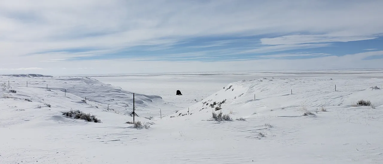
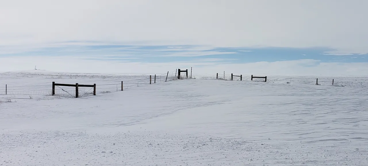
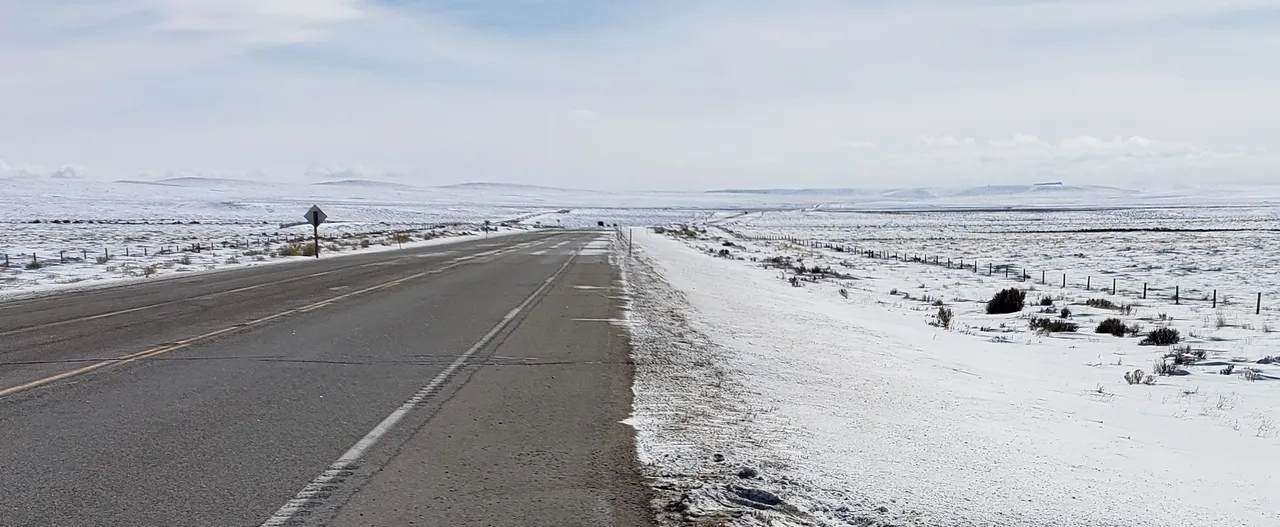
Photo: Wind-Swept Highways of Wyoming in Winter
The balance of my trip home was across roads like shown above. At first glance, it might appear relatively harmless, but the winds had gusts of +50 miles per hour ( 80 km / hour) in places. I drove past at least 3 18-wheel semis jack-knifed off the road, as well as 2 or 3 private vehicles.
Thankfully, I arrived safely at home without incident.
Closing this section of my post, I would like to draw your attention, dear reader, to what I just wrote above about leaving Rock Springs to return to college. To get my engineering degree. Which led to my "career" (although I had been working at various jobs years before that, starting with a paper route in grade school ...) beginning in Tucson, Arizona.
Interesting perhaps, then, that the beginning objective of my "road to recovery" trip was to go down into Arizona, "where it all began." Well ... Not really! Years before, my experience in Rock Springs, Wyoming led to this closing statement of the executive interviewing me for the job I subsequently accepted to begin my professional career:
"We weren't sure about making this decision, but you are the most mature college graduate I have ever met. I think you will do fine!"
I can assure you, dear reader, that whatever maturity he perceived me as having did not come from the classrooms of the University from which I graduated. It was based on all I experienced in Rock Springs, Wyoming ...
And "this decision" he was referring to was this international chemical company's decision to see if they could hire someone fresh out of college. To have them serve as a Regional Representative and make it work. Historically, they had only hired engineers with experience directly out of the mining industry.
I didn't let him down ... 😉
Conclusion of "Road to Recovery" Trip
Almost three months after writing my "plan your work" post - Reflections: My "Road to Recovery" Trip - I have now finished "working my plan."
In 30 days, I drove 4,984 miles through 10 states - down into the Great Southwest, out to the Pacific Coast of California, up into the Great Northwest, and back into the Rocky Mountain West. In so doing, I have created lifetime memories. And the posts about this trip "immutably enshrined" on our Steem blockchain will always be part of it.
There may yet be some posts about some reflections along the way through this "adventure." But there will be no more travel posts from this trip (aside from an "index" post with links to all of the others ...).
With that, "@roleerob's excellent adventure" is over. I am safely home. Back to my "real life" and responsibilities. And a final determination yet to be made about the "next chapter" of my life ...
Thanks for going along with me, dear reader. I hope you have enjoyed "seeing" through my eyes some of what the western United States has to offer you, if you ever have the opportunity to visit. I’d love to hear any feedback you may be inspired to provide.
Until "next time," all the best to you for a better tomorrow, as we all work together to build our Steem Community! 👍 😊
Respectfully,
Steemian @roleerob
Posted using SteemPeak and “immutably enshrined in the blockchain” on Sunday, 24 February 2019!
"R2R" Note: My "shorthand" way of referring to what I first wrote about in my Reflections: My "Road to Recovery" Trip post. "Road to Recovery" <=> "R2R" ... 😉
Image sources, unless otherwise noted: My trusty smartphone!


If you liked this post, you might enjoy others in my "Road to Recovery" Travelogue series:
- Travelogue, Day 1: Ribeye, Colorado
- Travelogue, Day 2: Navajo Nation and Canyon de Chelly - Awarded by c-cubed, c-squared, steemitworldmap, traveldigest, and trufflepig! 😊
- Travelogue, Day 3: Mogollon Rim, Copper Belt, and Sonora Desert - Awarded by trufflepig again!
- Travelogue, Day 4: Catalina State Park in Tuscon, Arizona - Awarded by c-squared, steemitworldmap, and traveldigest! 😊
- Travelogue, Day 5: Baboquivari, Sacred Peak in Arizona - Awarded by steemitworldmap and trufflepig! 😊
- Travelogue, Day 5: Organ Pipe National Monument in Arizona - Awarded by c-squared, steemitworldmap, traveldigest, and trufflepig! 😊
- Travelogue, Day 6: Reaching the Ocean - Awarded by travelfeed and trufflepig! 😊
- Travelogue, Day 7: Sabbath Rest and Morro Bay, California - Awarded by steemitworldmap, traveldigest, and trufflepig! 😊
- Travelogue, Day 8: Hearst Castle in San Simeon, California - Awarded by steemitworldmap and traveldigest! 😊
- Travelogue, Day 9: Monterey Peninsula of California - Awarded by steemitworldmap and travelfeed! 😊
- Travelogue, Day 10: Redwood Hill Farms and Sonoma County, California - Awarded by steemitworldmap and traveldigest! 😊
- Travelogue, Day 10: Sonoma Coast State Park of California - Awarded by steemitworldmap and traveldigest! 😊
- Travelogue, Day 11: Mendocino, California - Awarded by steemitworldmap and traveldigest! 😊
- Travelogue, Day 12: Redwood Forests of Northern California - Awarded by steemitworldmap, traveldigest, and trufflepig! 😊
- Travelogue, Day 13: Rogue River Gorge in Oregon - Awarded by steemitworldmap and traveldigest! 😊
- Travelogue, Day 20: Oregon Scenic Byway to Pendleton - Awarded by O.C.D., c-cubed, c-squared, and trufflepig! 😊
- Travelogue, Day 21: The Blue Mountains and the Palouse - Awarded by c-squared! 😊
- Travelogue, Day 23: Lewiston, Idaho and the Famous Lewis & Clark Expedition - Awarded by c-squared, steemitworldmap, and traveldigest! 😊
- Travelogue, Day 24: Saint Maries, Idaho and Lake Couer 'd Alene - Awarded by O.C.D., c-squared, steemitworldmap, and traveldigest! 😊
- Travelogue, Day 26: Palouse Scenic Highway and Farmington, Washington - Awarded by O.C.D., c-squared, steemitworldmap, and traveldigest! 😊
- Travelogue, Day 28: Northwest Passage Scenic Byway. In winter ... - Awarded by O.C.D., c-squared, steemitworldmap, and travelfeed! 😊
- Travelogue, Day 29: Big Hole Valley in Montana. In winter ... - Awarded by curie, c-cubed, c-squared, steemitworldmap, and travelfeed! 😊