
All photos: CC BY-SA 4.0 - Insaneworks
Finlayson, a former factory area. Map: 4
Tampere lies in between two lakes. In the north we have Näsijärvi (Näsi lake) and in the south we have Pyhäjärvi (Holy lake). Rapids called Tammerkoski connects the two lakes. Walking from one lake shore to another takes only about 15 to 30 minutes or in worst case scenario, several hours.
The accurate time can be calculated with a complex mathematical formula that has at least two variables. At winter the two biggest are: how eager you are on keeping yourself warm in the cold winter, and how addicted you are on taking photographs on every step you take. So you eather get pics of your 15 minute walk or you get awesome photos and freeze your ass and fingers. So for a photoholic, might take several hours. If you are one, better admit it straight away, dress accordingly if it's freekishly cold and send the rest of your party to eat and drink well while you are taking that one more perfect shot.
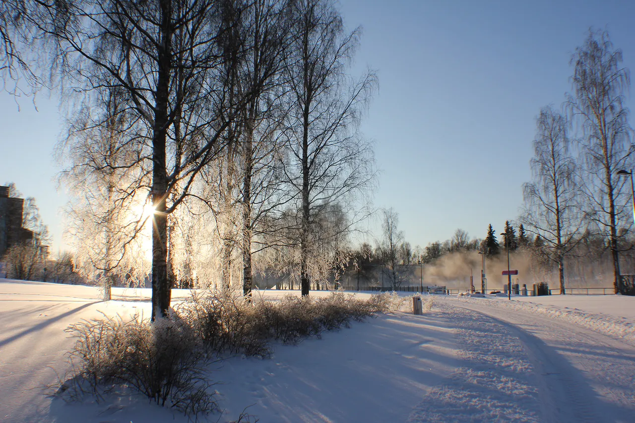
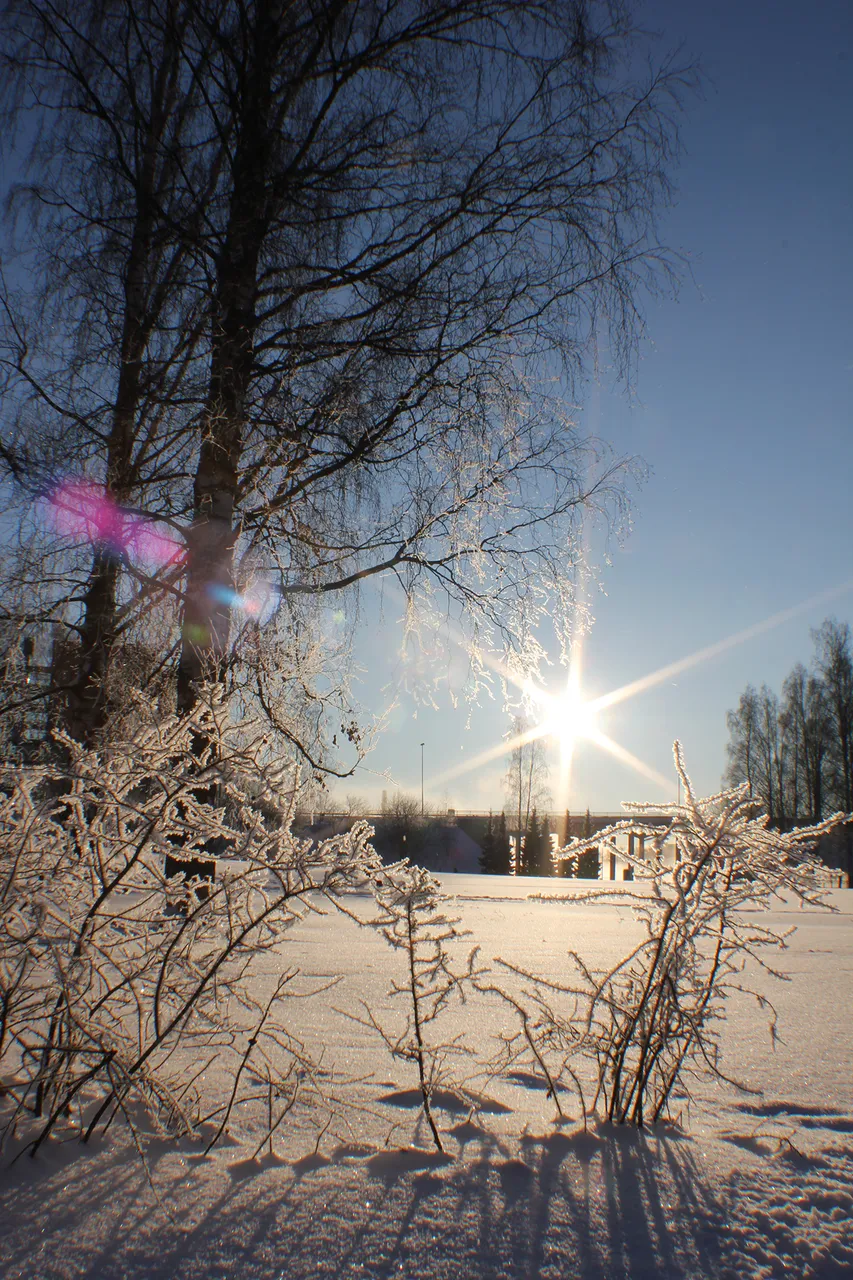
Let me take you to a walk thru Tampere. From Näsijärvi to Pyhäjärvi. From moonset to sunset. And with the last link to sunset. For me this took about two hours. Didn't freeze myself that much because TRUST ME, I KNOW WHAT I'M DOING!
#Steemitworldmap map point is in the middle of the Tammerkoski (Tammer rapids) because most of my photos were taken around the rapids. But if you want to know the exact locations, look for the sup text and number, search the same number from this google map picture below and you'll find a more accurate location.
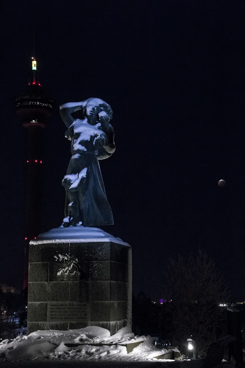
Let's continue the journey thru Tampere from my previous post about Siilinkari (hedgehogs shoal or skerry), where I mentioned the accident of the steamboat Kuru (kuru = gulch, gorge) in 1929 that took 136 lives with it.
There is a monument for Kuru accident in Näsinkallio (rock of Näsi). It was revealed on the 11th memorial day of the ship wreck, 7th of September 1940. The sculpture depicts a woman standing on a high pedestal with her child in her arms. The other child is leaning against the woman's skirt. The woman's right hand is raised behind the head. The woman has turned her back to Näsijärvi and Siilinkari, the site of the Kuru ship accident.
The next photo was taken January 21st 2019, perhaps 15 minutes after the total lunar eclipse. Behind the monument for the Kuru accident is the Näsinneula (needle of Näsi), that is 168 meters high with the needle and 134,5 meters high without it. The Näsinneula has a rotating restaurant and a observation post, so if you visit Tampere, I absolutely recommend this place. Näsinneula is in the middle of Särkänniemi (reefs cape) amusement park and near it locates also the Sara Hildén's art museum. Rolling, twirling, twisting and getting wet in tukkijoki (log river) is highly recommended. Unfortunately the amusement park is only open at summertime.
Photos: CC BY-SA 4.0 - Insaneworks
"In the northern storm of September 7, 1929, the steamer Kuru
keeled in Lake Näsijärvi near Siilinkari and 138 people were killed in waves."
"Vuonna 1929 syyskuun 7. päivänä raivonneessa pohjoismyrskyssä höyrylaiva Kuru
kaatui Näsijärvellä lähellä Siilinkaria ja 138 ihmistä sai aalloissa surmansa."
Map: 1
 |  |
|---|
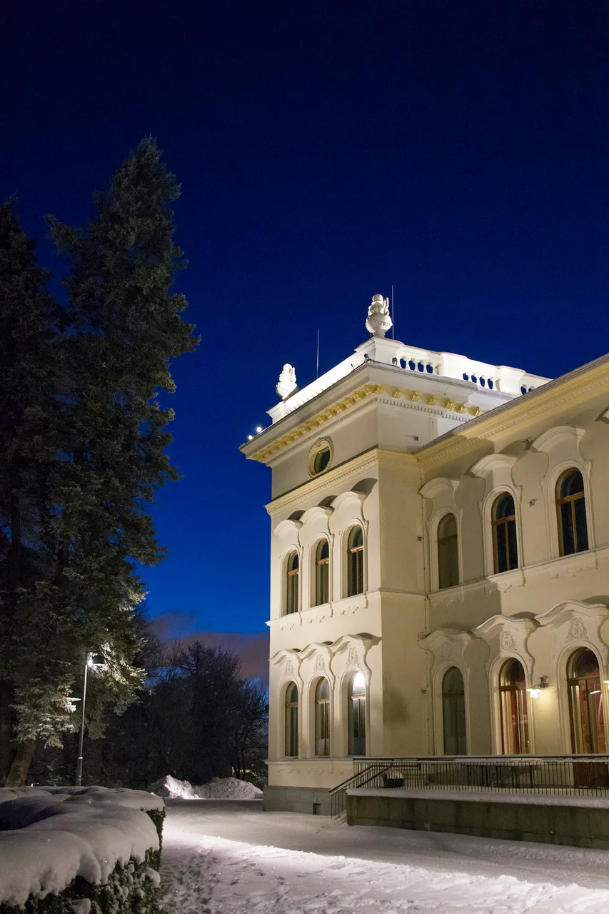
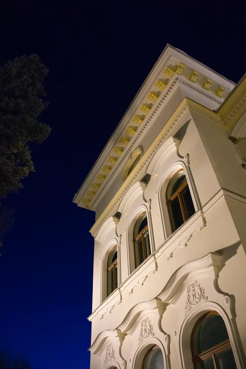
Näsilinna (Näsi castle or palace) is on the top of the Näsinkallio. It was built by Peter von Nottbeck in 1898 and the original name is Milavida. Currently the palace has a Milavida museum, restaurant and a cafeteria, so you can go and fill yourself with history, food and drinks.
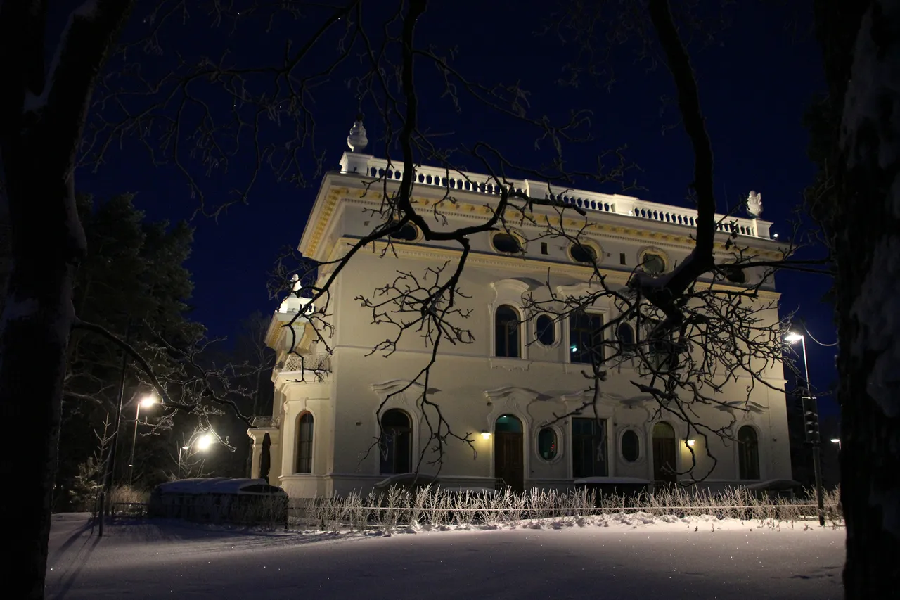
Milavida museum / Näsilinna Map: 2
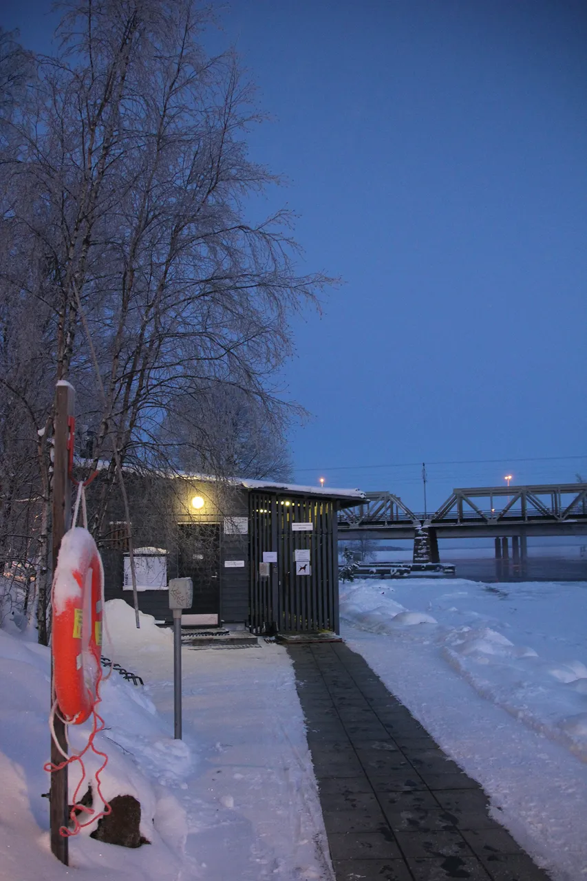
If you are here in Tampere at the wrong season and you did not get a change to spin in any twister machines or get wet, now's your change! Just roll down the hill and make sure you get yourself in to the rapids at the right spot. Here's your change to go to sauna and swim, no matter the season. Just remember to swim inside the buoy line or in the ice free spot that is kept open for avantouinti! (swimming in the ice hole)
Mältinranta (The beach of Mältti). Air: -20°C, water: 0°C sauna: approx +70°C. Such fun! Map: 3
Photos: CC BY-SA 4.0 - Insaneworks
 |  |
|---|
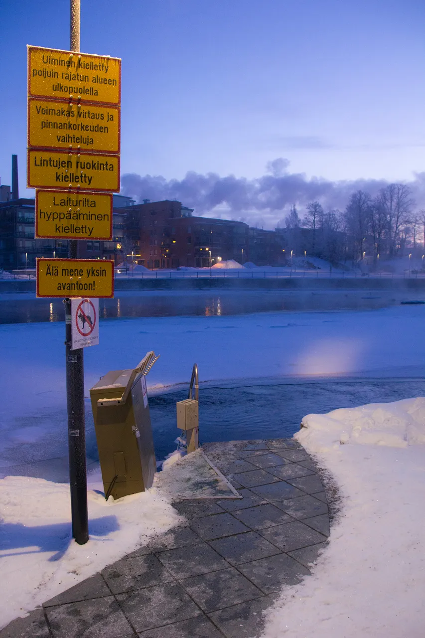
From a hot modern sauna to icy cold ice hole! The signs say: Swimming not allowed outside the buoy line. Strong current and variations in water level. Do not feed the birds. Do not jump from the pier. Do not go alone in to the ice hole!
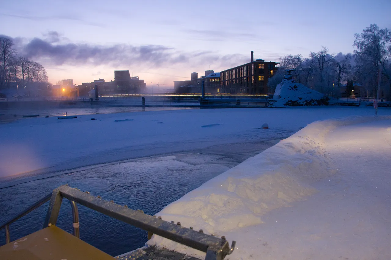
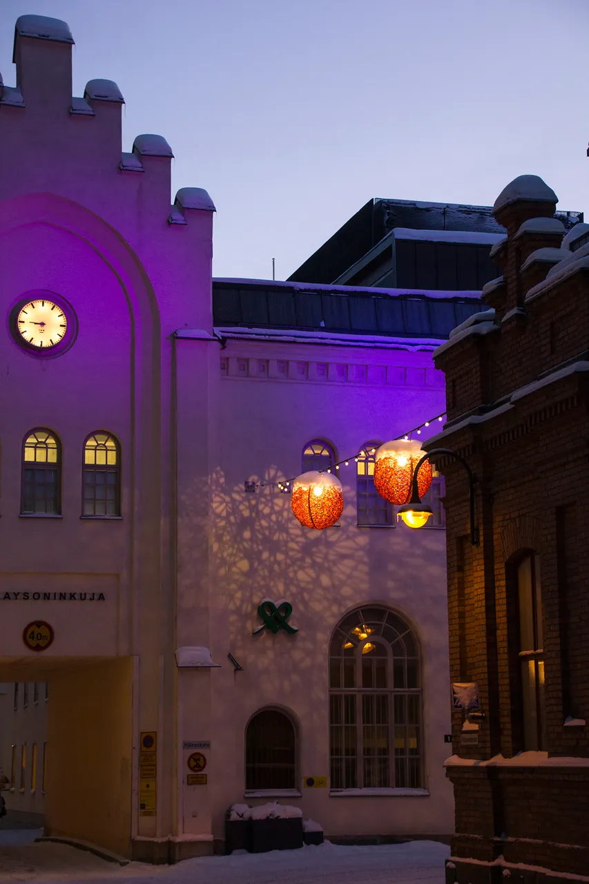
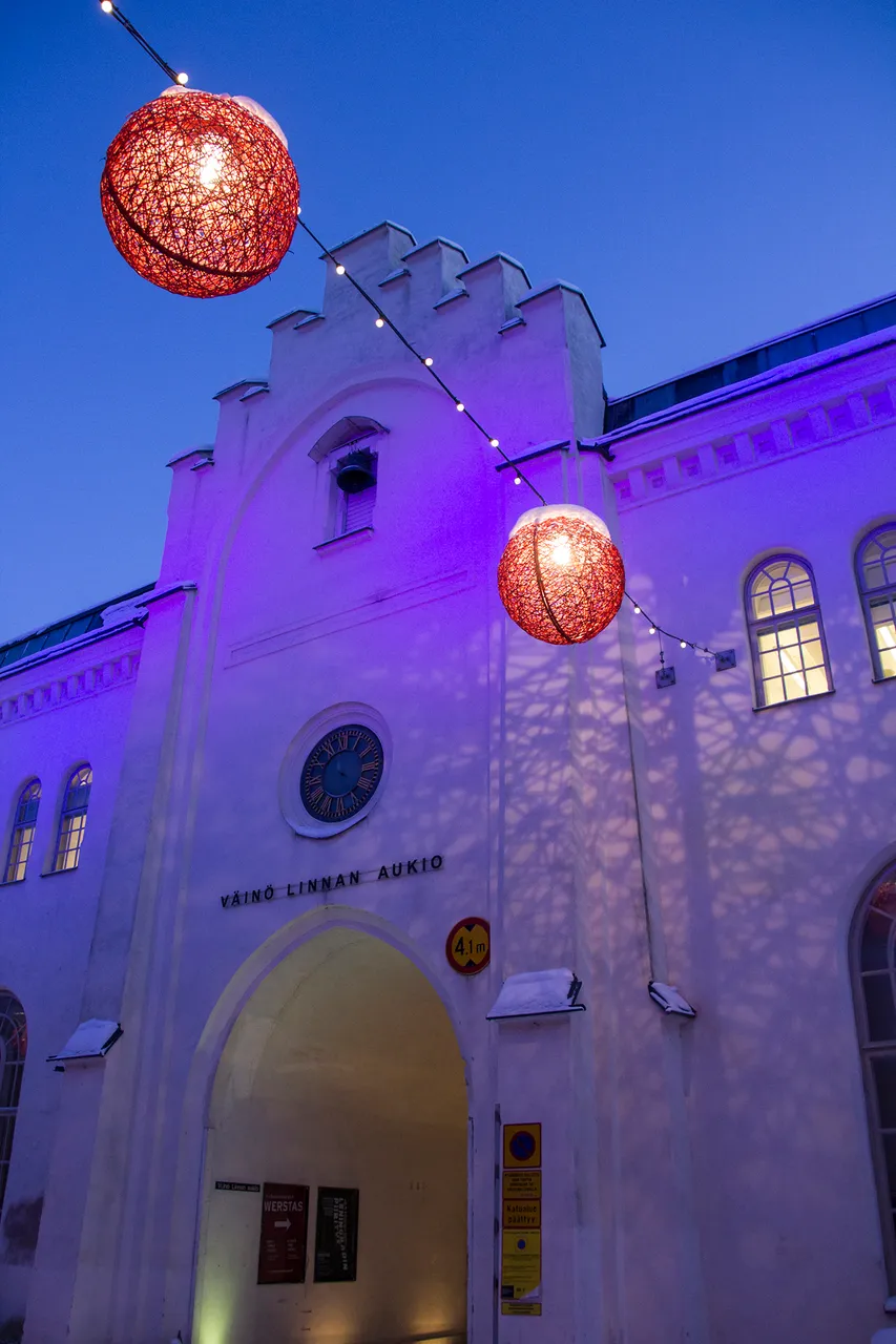
Over there, further down to the rapids, you can see a bridge, a dam, few apartment houses and the old Finlayson factory area.Map: 3
Finlayson used to be a factory area. Map: 4
James Finlayson, a Scottish engineer, founded a machinery by the Tammerkoski rapids in 1820. Eight years later his company Suomen puuvillateollisuus (Finnish Cotton Industry) started producing cotton textiles with the machines built by him. In 1836 the Finlayson cotton mill was sold to businessmen from St. Petersburg, Wilhelm Nottbeck and Georg Rauch. The oldest building in the area, the Old Factory, also called Kuusvooninkinen (an archaic name for a building with six floors), was completed in 1837.
 |  |
|---|---|
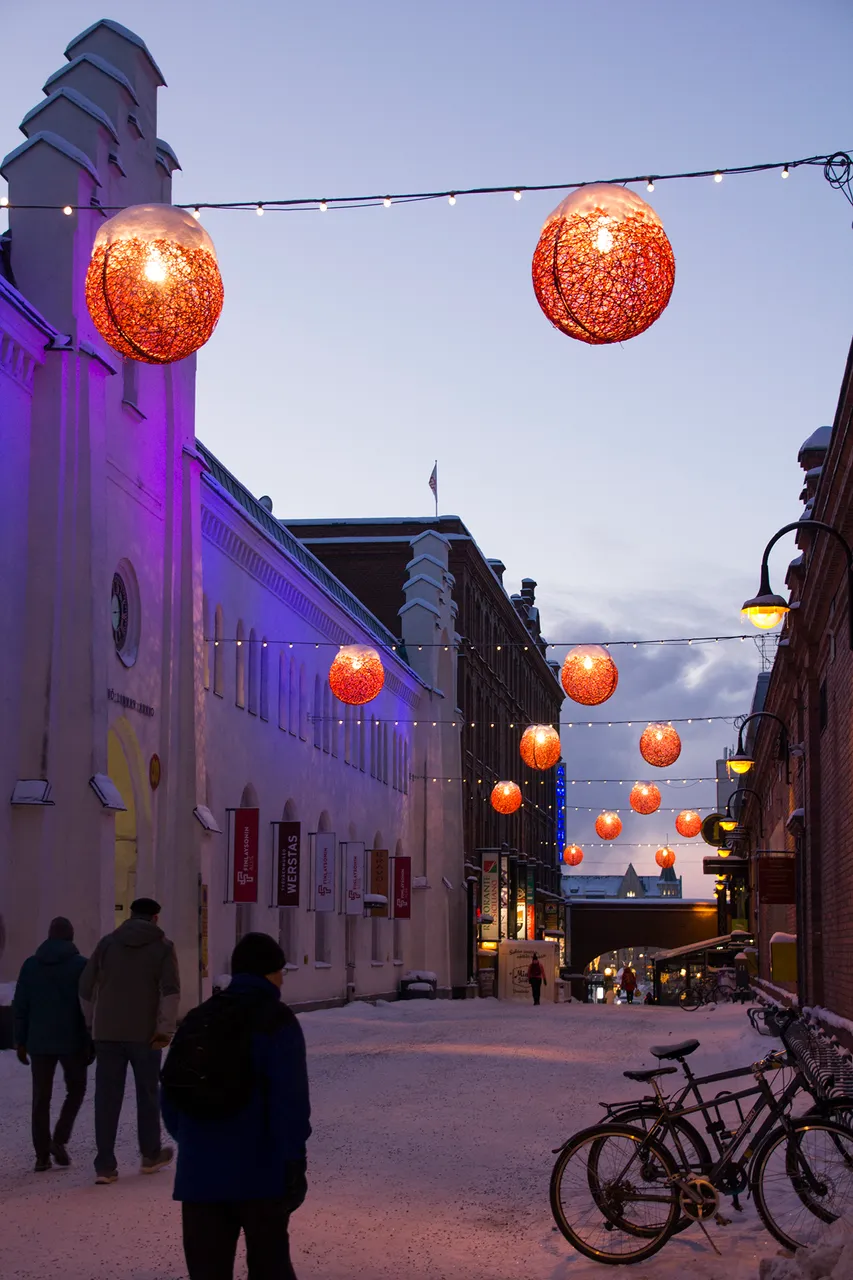 |  |
In the 1800s Finlayson grew to be a city within a city with its own school, a hospital, police force, and for a while, even its own currency. For the workers, it was easy to identify yourself as a Finlaysonian. Until the 1920s, the Finlayson company was the biggest industrial business in the Northern countries. The Finlayson company shut down its industrial functions in Tampere in the 1980s, but there is still a factory boutique nearby at Kuninkaankatu. (Kings street)
Photos: CC BY-SA 4.0 - Insaneworks
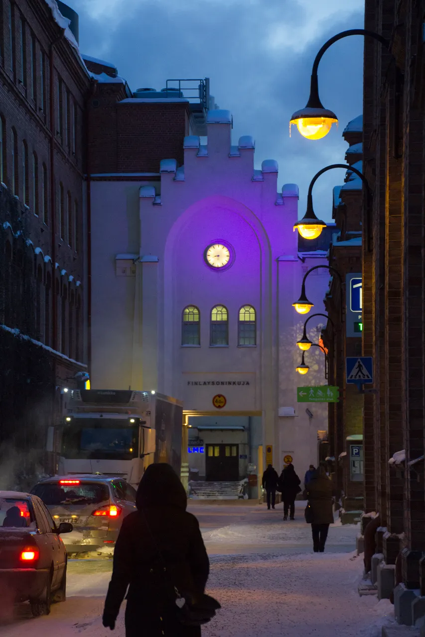
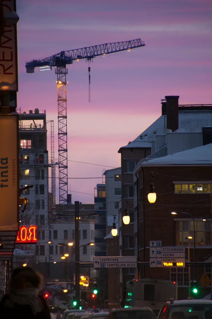
One of the busiest streets nowadays is Satakunnankatu Map: 5 (hundred municipalities street) due to the tram line being constructed to the Tampere main street, Hämeenkatu. If you do want to avoid traffic, walk or cycle more than drive a car, or avoid the city centre during rush hours. If you are from a big city, the "traffic" and the "delays" for you are probably something that you would not even notice. So my advice to you is to kidnap yourself a local to whine about it. A car owner. Perhaps a professional. A taxi driver. So now you get the real experience of Tampere when you have a true Finn, a Tamperelainen (a local) complaining to you about the "horrible" traffic and inconvenience that we now have here because of all the construction sites and changes.
The tram line should be ready and running in the year 2020. No matter how the caraholics feel about that.
Photos: CC BY-SA 4.0 - Insaneworks
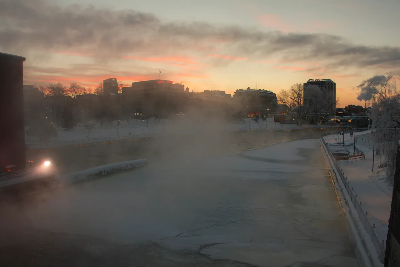
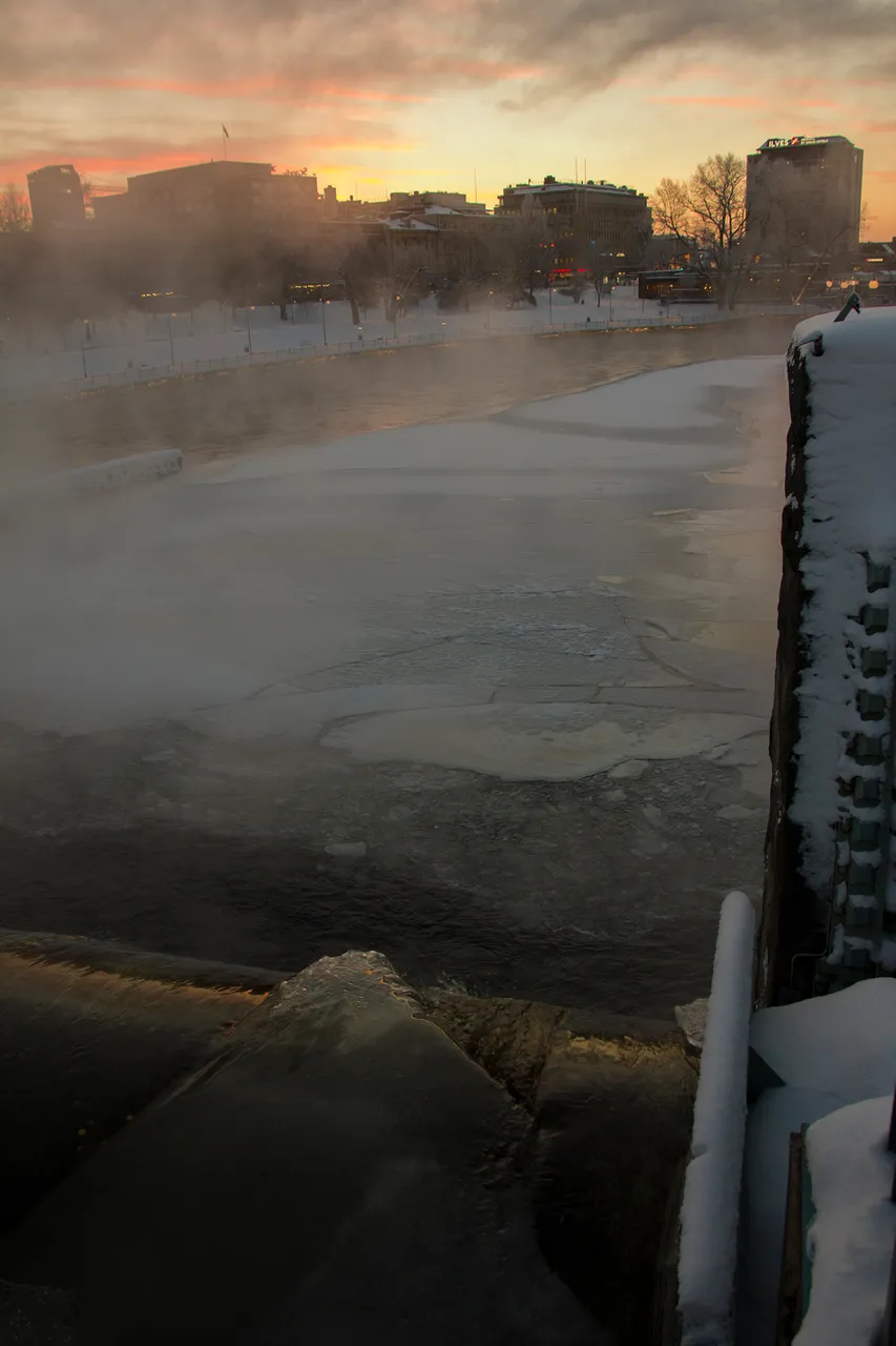
Tammerkoski Map: 6 photographed from the top of the dam. On the other side, Koskipuisto (rapids park) and Hotel Ilves, Hämeenkatu and few other landmarks that I hope to cover in upcoming posts. And of course the vivid colours of the sunrise.
Photos: CC BY-SA 4.0 - Insaneworks
Photos: CC BY-SA 4.0 - Insaneworks
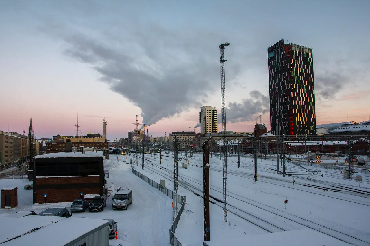
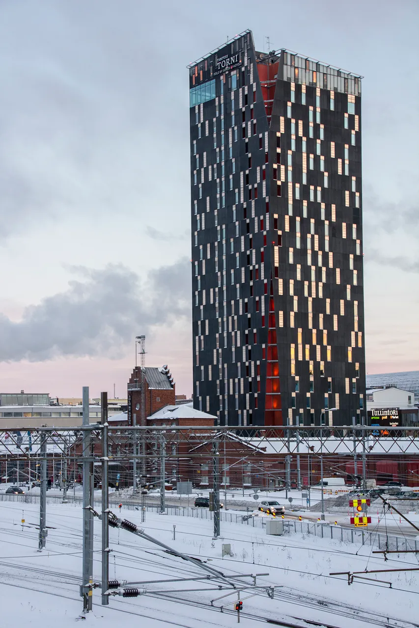
The second best place after Näsinneula to see the whole city, is definitely the dark tower. And no, that's not it's real name. I just want to call it black tower because, well, it's pretty black and it's a tower. This tower is called Tampere Torni (Tampere Tower) and The Tower Hotel. Map: 7 The black tower is a good landmark if you want to find the railway station.
Photos: CC BY-SA 4.0 - Insaneworks
 |  |
|---|
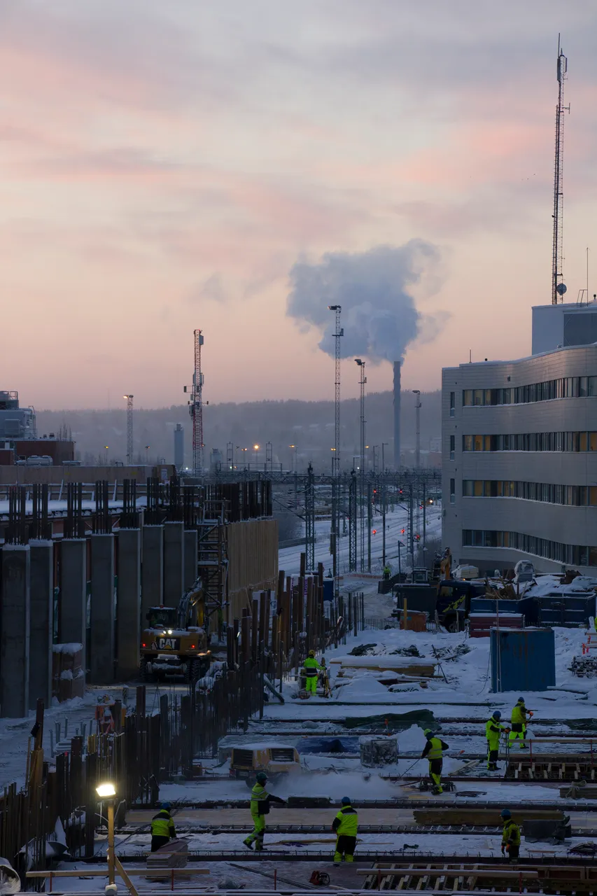
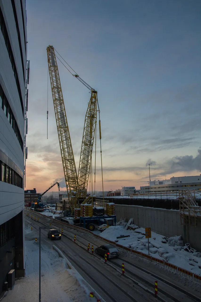
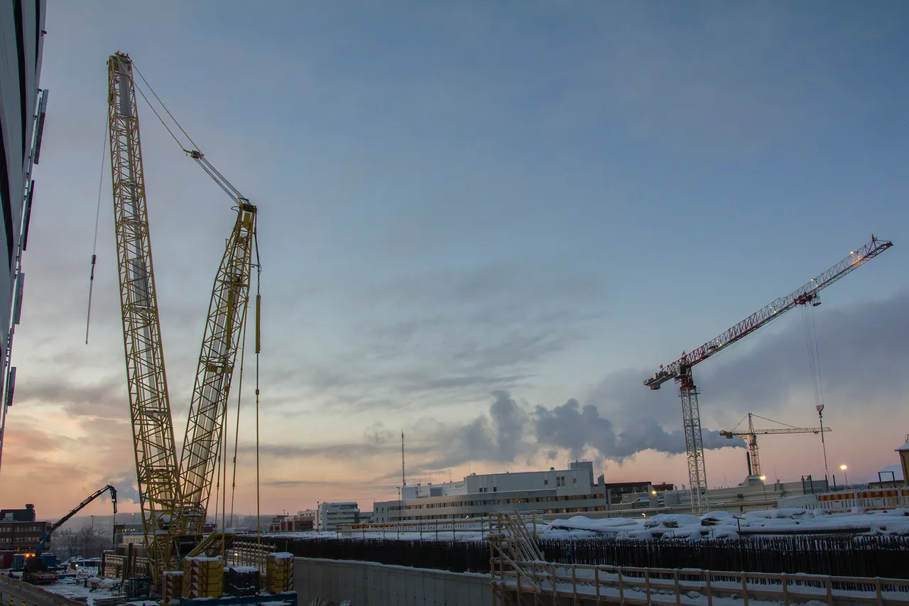
I was standing on the Sorinahde bridge (Sorry's hillside Yes, pretty loose translations.), or sometimes called also Sorinsilta (Sorry's bridge) when I took the pictures of the black tower on the north side and this construction site on the south side of the bridge. Map: 8 As you've already learned, there are lots and lots of construction sites in Tampere at the moment. This is one of them. Kansiareena (Lid or a cover arena) is supposed to be ready in the year 2021 and the whole kansiprojekti (lid / cover project) ready by 2024. When it's ready, Tampere has a lid over the train tracks south from the railway station and on it, an arena for sports and few other tower buildings. Not black but white. At least that's how the architects have visioned the buildings to be. I have also seen trees in the sketches of the lid project, but I'll suspect the trees were there just to amuse the architects.
Photos: CC BY-SA 4.0 - Insaneworks
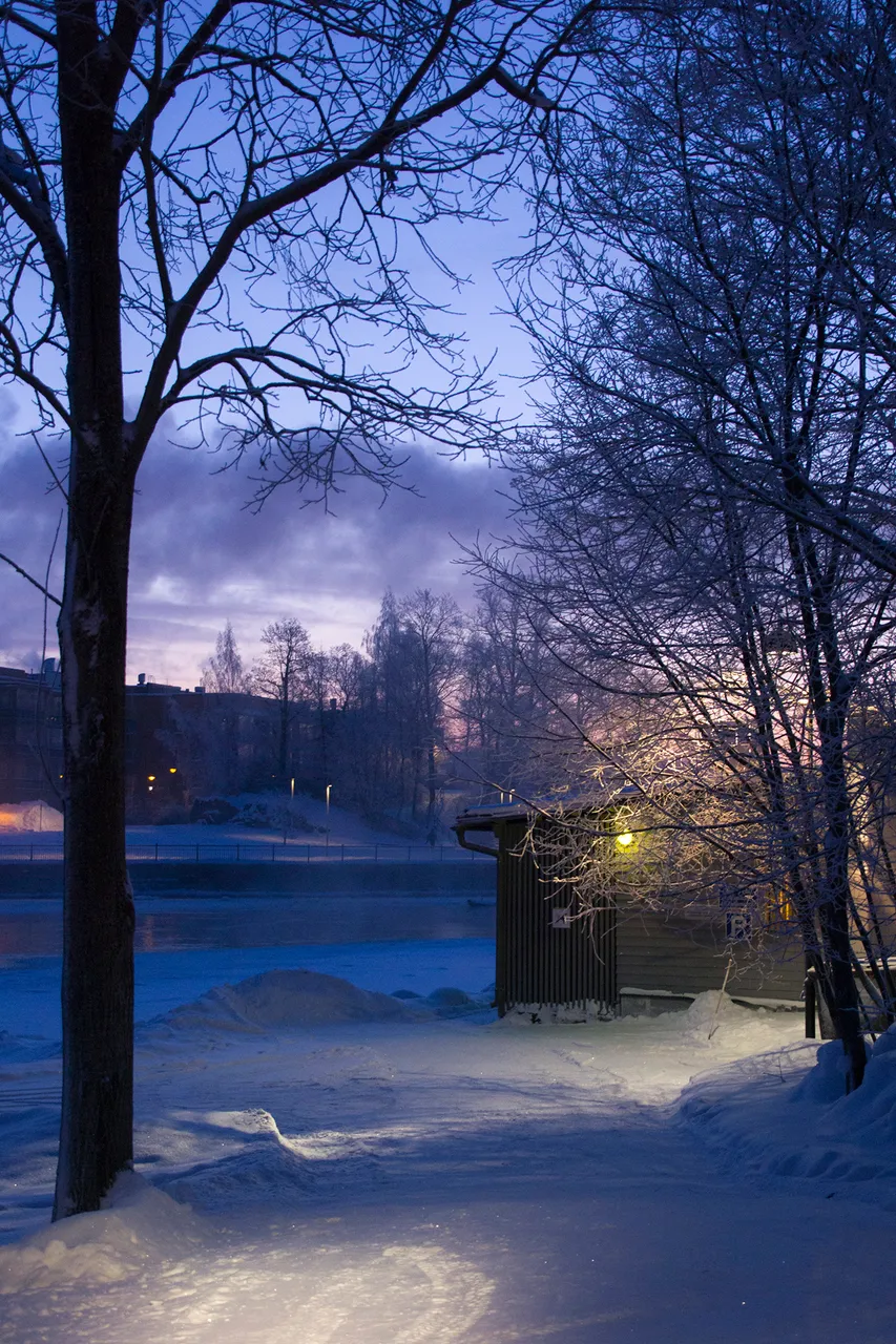
Finally we are really near the other lake in the south side of Tampere. The Holy lake (Pyhäjärvi).
Actually my two hour trip ended to the Sorinsilta and the following photos are from one to two days before the photos you've seen so far, but who cares? I don't. What matters most is the story, right? Besides I could have easily continued further towards the Pyhäjärvi and that would have only been an extra 2 hours. Not because of the distance, but because of the photographing. (Just one more... and one more... and one more...) So let's all imagine I did walk straight from the Sorinsilta to Ratina and continue photographing. And that my fingers weren't already frozen and the batteries almost dead from my camera.
Photos: CC BY-SA 4.0 - Insaneworks
Map: 9
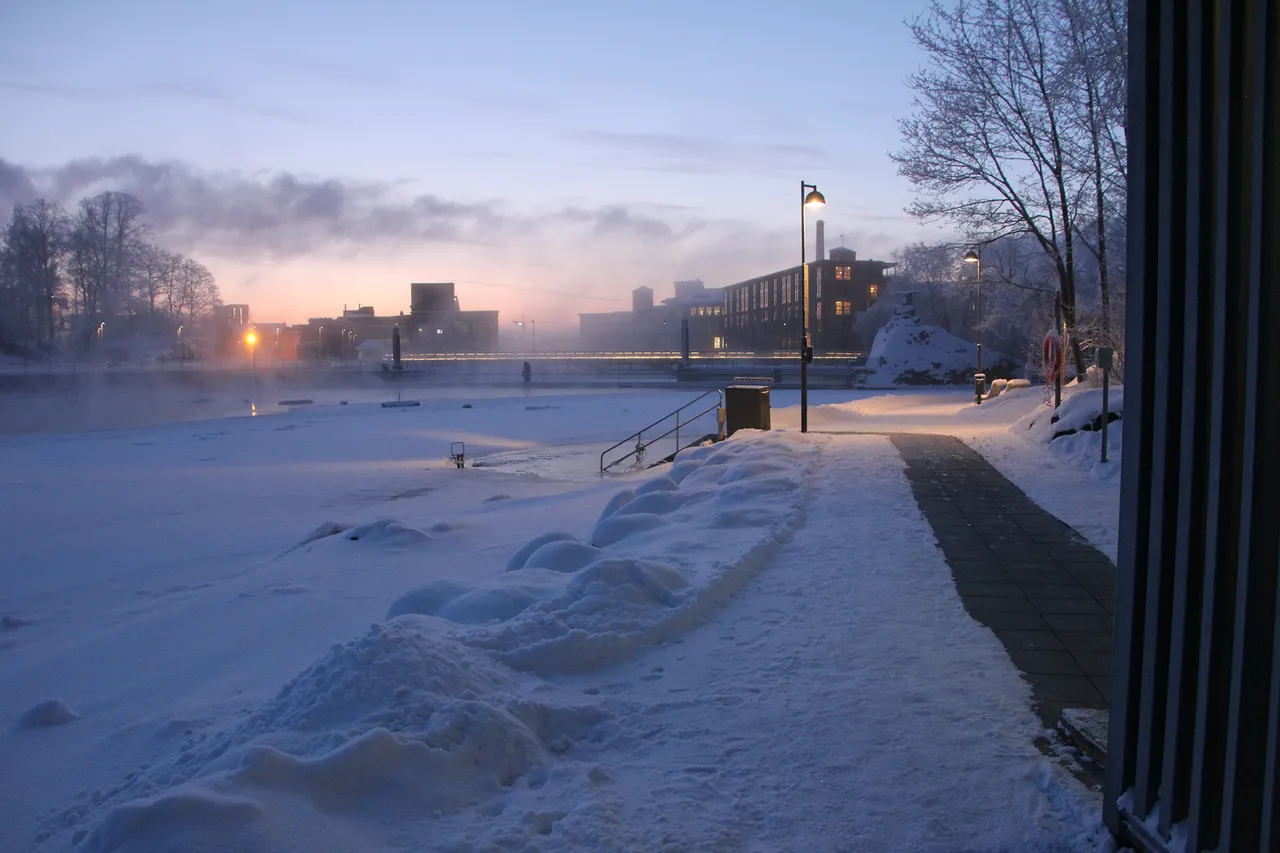
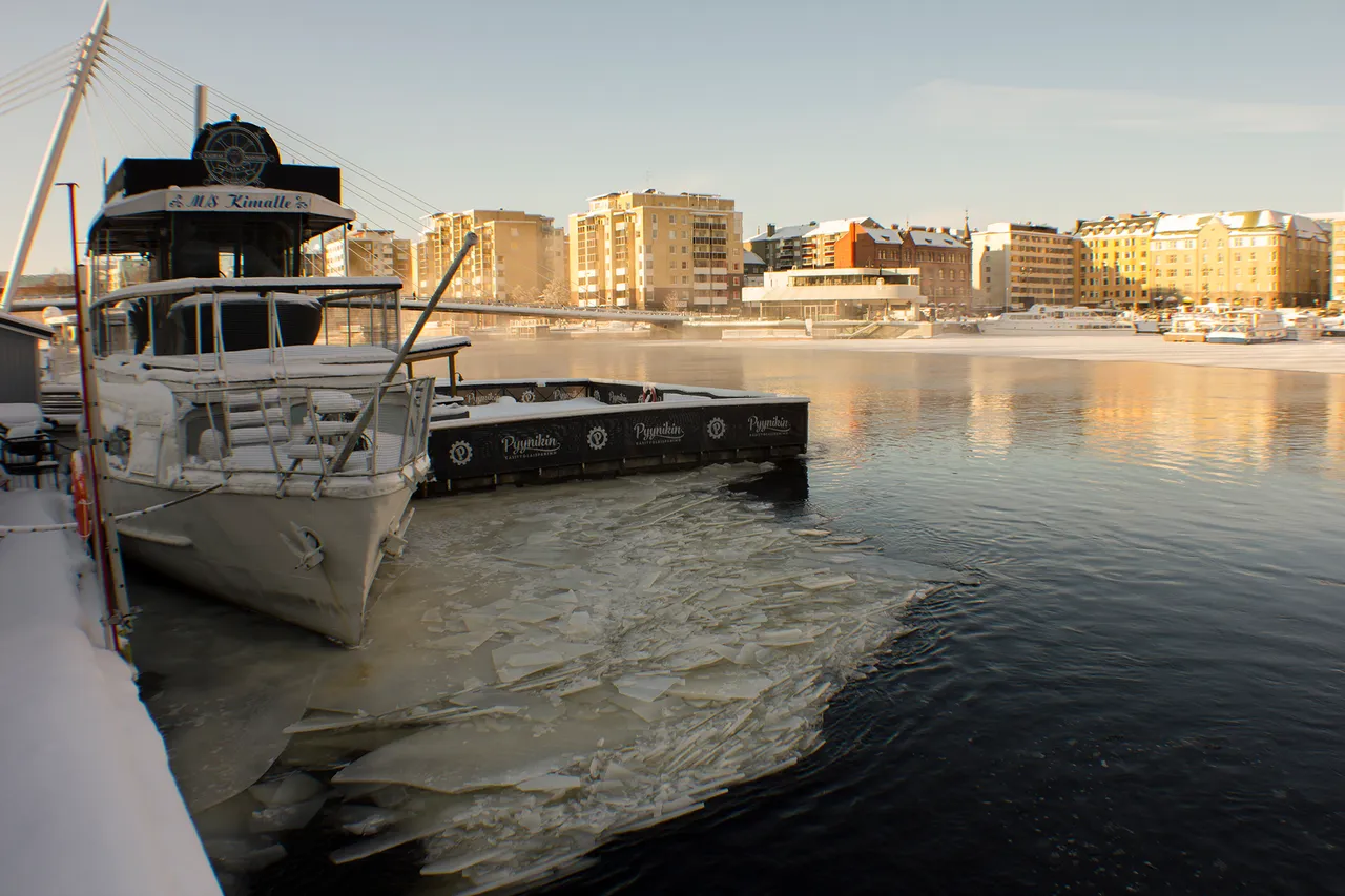
Ratina has a small harbor where you can (in the summer) catch a boat to Viikinsaari (Viikkis island) or further to Pyhäjärvi, eat and drink in the Laukontori (Laukko square) or in the ships that just sit there for the joy of alcohol drinkers. Or just buy strawberries, ice-cream and coffee from Laukontori in the summer and watch the people walk by. Laukontori is on the other, sunny side of the harbor and very near is also the Ratina Stadium and The Ratina shopping centre.
The last two photos take you towards the Pyhäjärvi. You are just few steps away. Follow the path and...
Photos: CC BY-SA 4.0 - Insaneworks
Map: 10
Photos: CC BY-SA 4.0 - Insaneworks
Map: 10
...go under the Ratina bridge and there you are, on the shore of Pyhäjärvi. Right there where my Mana and Manas new friend were watching the sunset last year, 2018.
Welcome to Tampere, Finland!
From needle to ice hole, from sauna to under the bridge. From moonset to sunset, everything within the walking distance.
!steemitworldmap 61.501536 lat 23.761829 long Welcome to Tampere - From Moonset to Sunrise d3scr
#winter #icehole #winterswimming #rapids #tammerkoski #snow #milavida #finlayson #hoteltower #mooneclipse #sunrise #architecturalphotography